2025 Trans Taiga trip photographs Part A
The trip overview. The total drive is about 3400 miles, with the last 500 or so on the Trans Taiga Highway (TTH), an improved primitive road that services four dams on the La Grande River. I left Henderson July 4th, stopped in Douglas Co., WI on July 6th, and Cook Co., MN July 7th. July 9th I stopped north of Geraldton, ON, July 10th Fraserdale, ON, and July 11th I made it to Route 1055, just east of Matagami, QC.
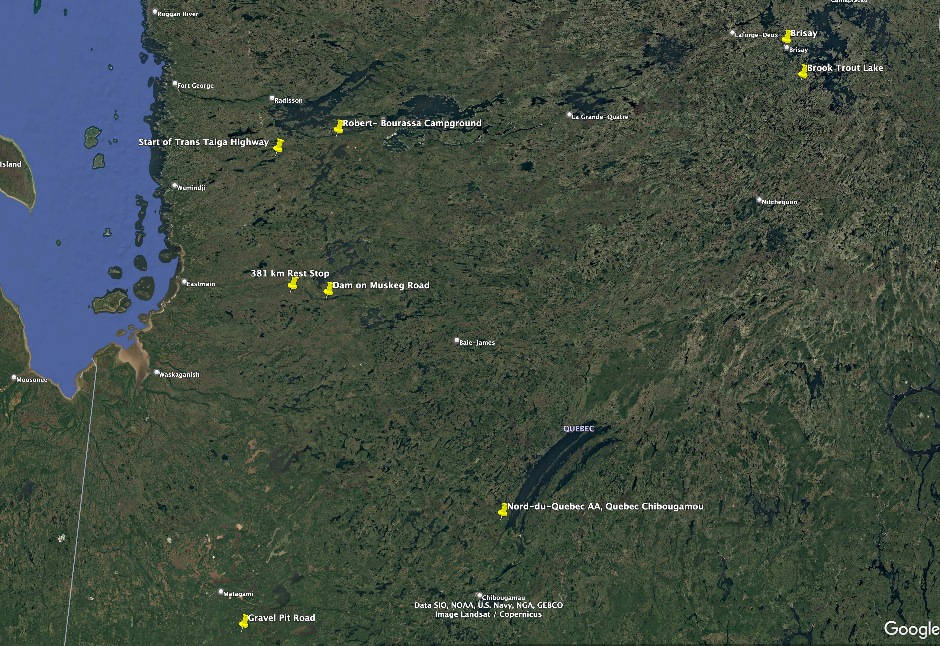
This Google Earth image shows all spots for which I collected Polygonia faunus, my target species for the trip, as well as several locations that I will reference in this post.
On July 7th, I walked along S. Fowl Road in NE Minnesota, a good spot for Polygonia. No fresh specimens were on the wing, in fact, most butterflies were delayed, ie, not flying on the date that they should have. This is toward the end of the road, a fen that crosses the road.
On July 10th, I visited Fraserdale, ON. This is a ghost town in eastern Ontario north of Smooth Rock Falls. The logging roads are good butterfly habitat, and many were on the wing today. This is Limenitis arthemis arthemis, often abundant the first 2 weeks of this trip.
On July 11th, I walked Route 1055 just west of the access road to the large gravel pit. A Colias interior.
Another L. arthemis.
Another C. interior. This one is lying on the road to maximize exposure to the sun, as this was late in the afternoon.
This is Coenonympha california tullia, also sunning itself.
Another L. arthemis. These show some variabilty in the patterns, especially the banding along the lower hindwing.
Phyciodes cocyta. Usually quite common, but rather spotty on this trip.
A Limochores mystic.
This is Euphyes vestris metacomet. BTW, for you non-butterfly folks, when I list 3 words for the name the third is the subspecies.
Another L. arthemis. Note that this specimen has red banding along the lower hindwing - compare to the previous photograph.
Another C. interior.
Another L. arthemis.
This is a Hummingbird Moth, Hemaris thysbe.
This is a very old and worn Polygonia faunus faunus, my target species. This one is almost a year old, as these emerge in August, hibernate in early September, and fly and lay eggs in the spring. I would return here August 14th to collect fresh specimens.
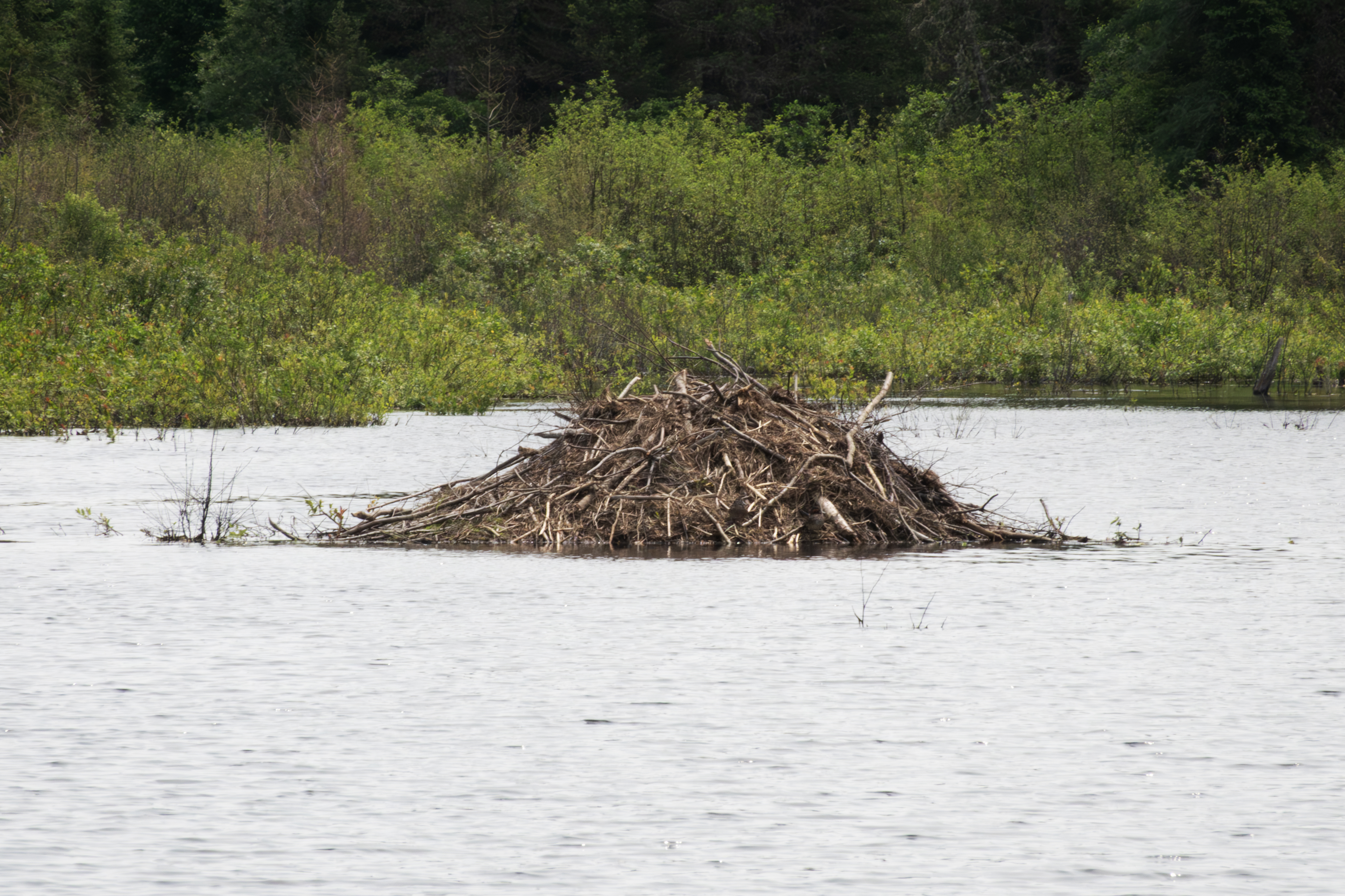
Beavers routinely dam the fen crossing this access road. Some years the dam is present, and some years not.
Looking toward the lodge.
The drainage end of the dam.
A closer view of the dam. These have younger plants and serve as good hosts for Polygonia larvae, especially Polygonia satyrus.
The lodge.
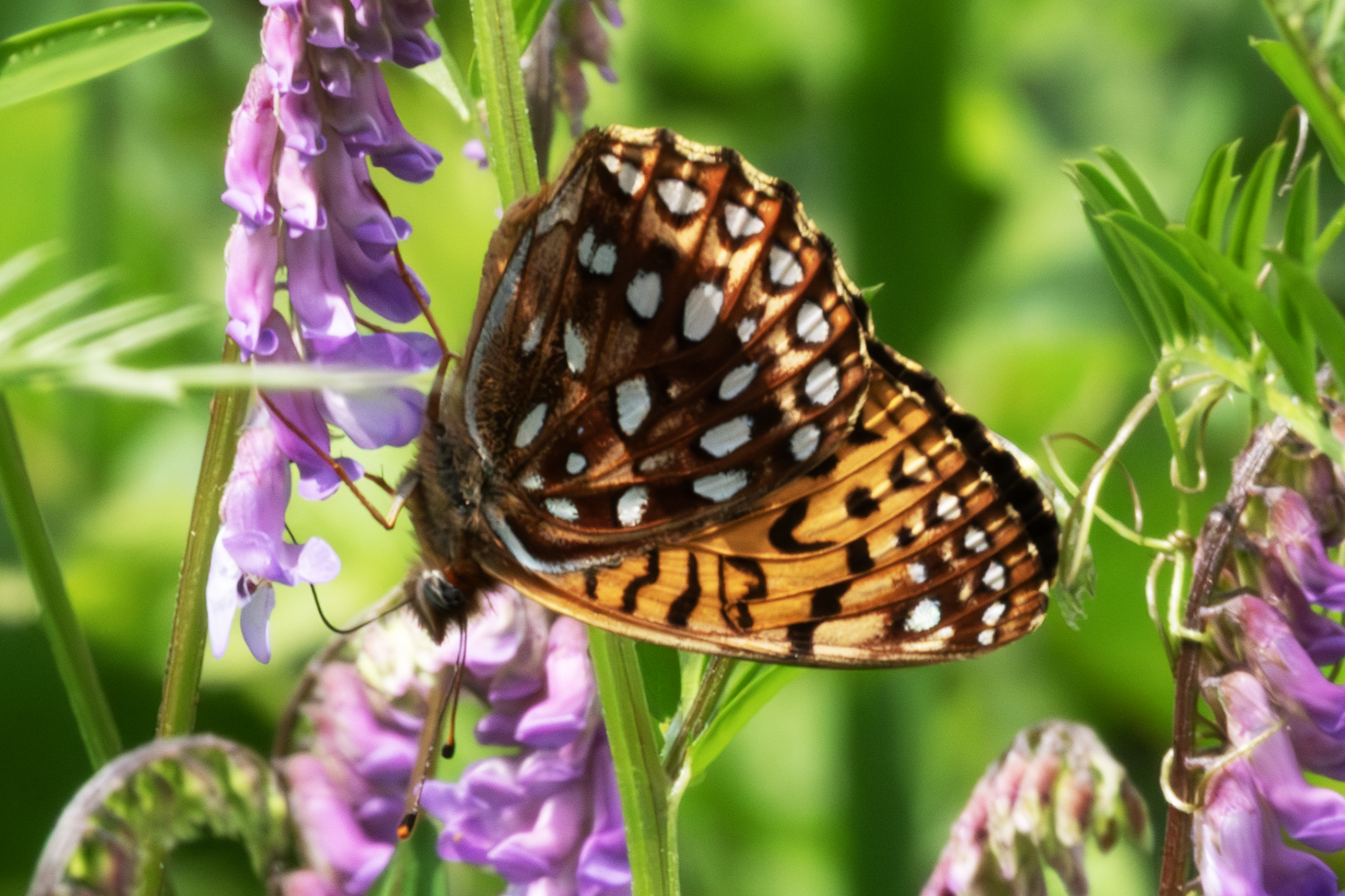
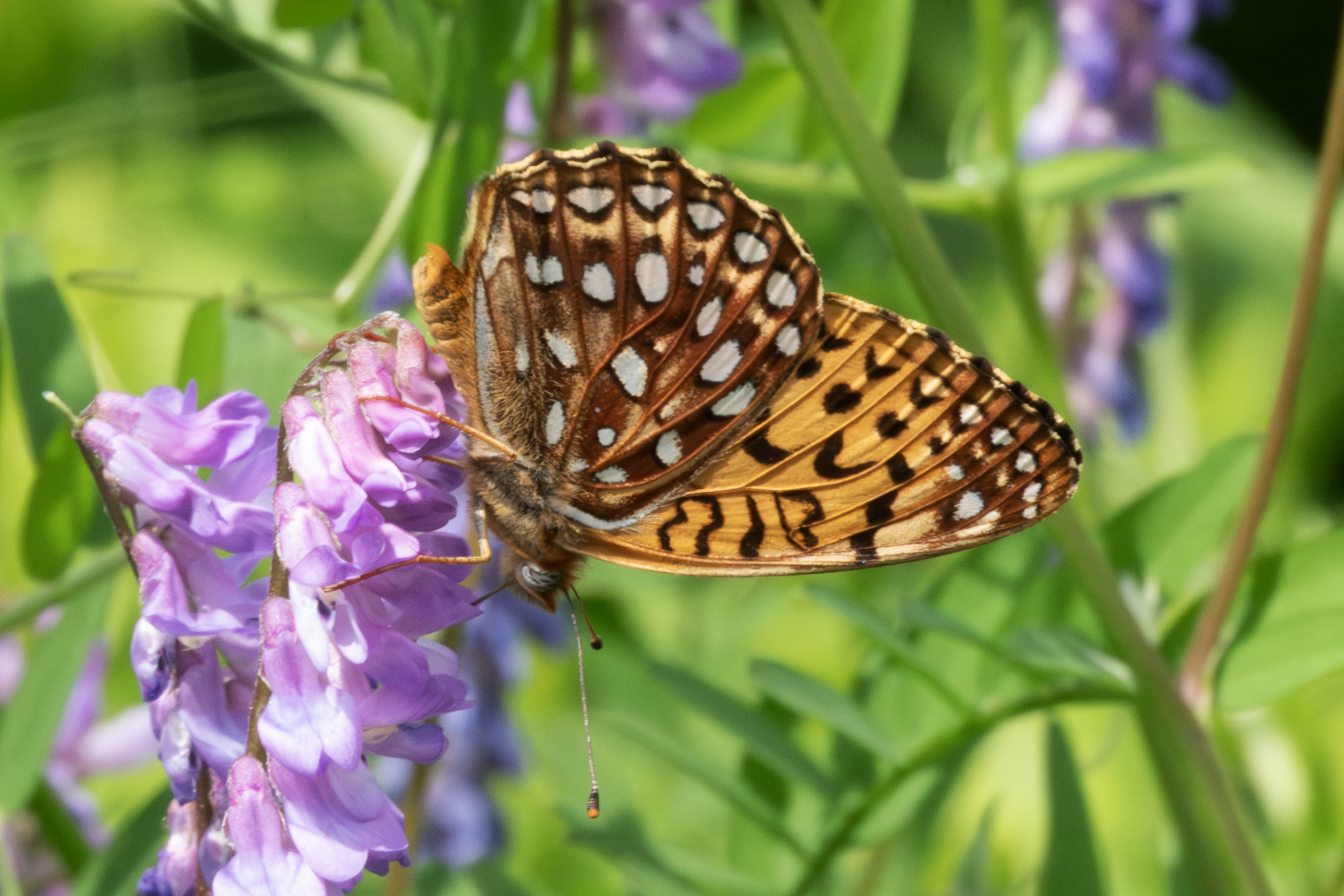
Speyeria atlantis atlantis, very fresh.
Another photograph.
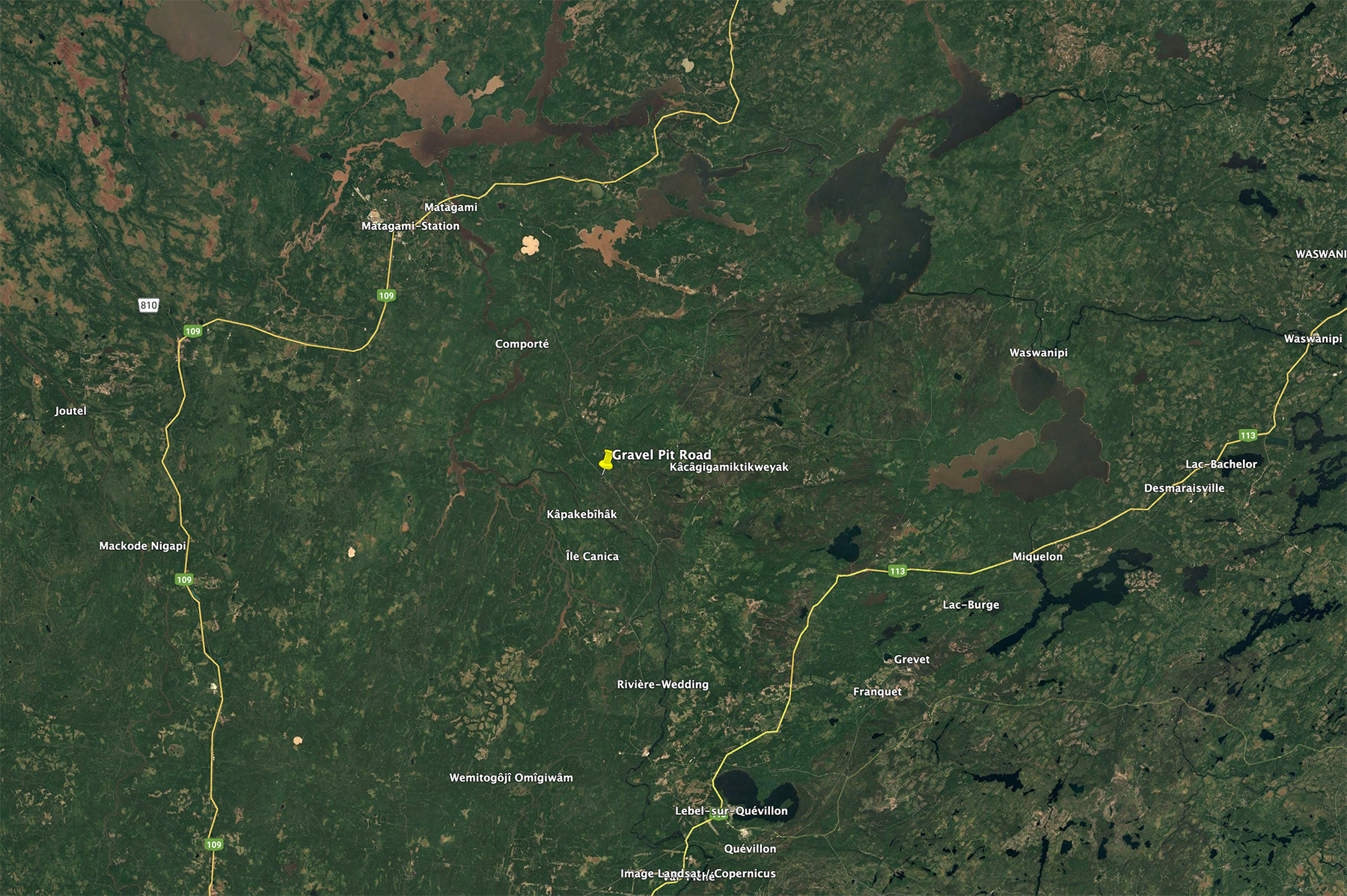
This is an overview of the gravel pit location, located halfway between Matagami and Quivillon. Matagami is just a few kms south of the start of the James Bay Highway, which I will drive the next two days to access the Trans Taiga Highway.
This is an overview of the distance from Matagami to Radisson and the start of the Trans Taiga Highway.
The 381 km rest stop is the only gas station on the route, and offers free showers and a restraunt.
This shows the northwest portion of the drive. Radisson is about 75 kms from the Trans Taiga Highway. No gas at this intersection, so one must plan either a stop in town or one at the outfitter at 358 km on the TTH. The large bodies of water are reservoirs 2, 3, and 4 from right to left.
This is the campground I stayed several times on the trip. Good fishing for northern pike at the point just to to left of the campground. The walleye spot is along a inlet to the Sakami River, just a 10 minute hike from a rest stop at 61 km. The access road is at 62 km. I would collect butterflies here several times, including P. faunus August 9-12.
A sample turbine, located in Radisson.
On July 16th, I stopped at the 358 Mirage Outfitter for gas, and then just east on the highway stopped at this beach for a bird bath.
I fished a culvert at this spot, which are usually good for northern pike, but had no luck.
Just to the left of the previous photograph.
Just to the left of the previous photograph.
Looking east at 480 km.
A river crossing about 30 miles east of Brisay.
Cree have many camps along all roads in the north. Here is one example. They spend about 7 months at these.
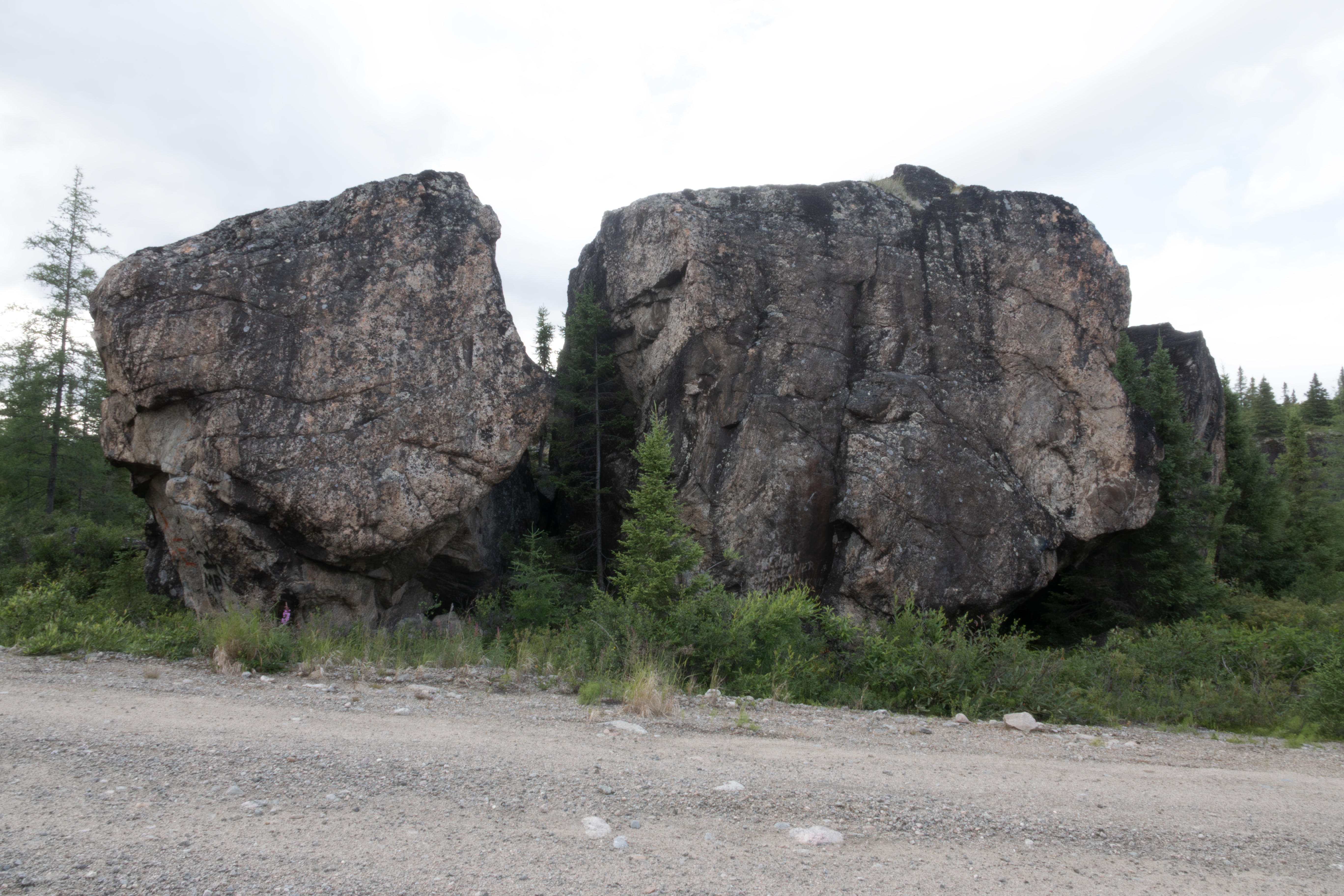
Nice scenery shot.
This C. interior was laying flat on the taiga to absorb sunlight.
These C. interior were feeding on mushrooms.
Another river crossing.
I made it to Brisay the next evening. The next day, July 18th, was raining on and off. This is the boat launch to the north of Brisay. The water had dropped 5 feet from the night before. The northeast USA had been experiencing a heatwave that broke that day, so the dam needed to generate less power, and therefore released less water. Too bad, as I had caught lake trout just past the large rock with the pipe the night before. The water was now too shallow for the fish.
The dam from an observation tower.
Looking toward the river and boat launch.
This Herring Gull was dining on the remains of a lake trout that I had caught the night before. Two weeks later there was not a speck of meat on this carcass.
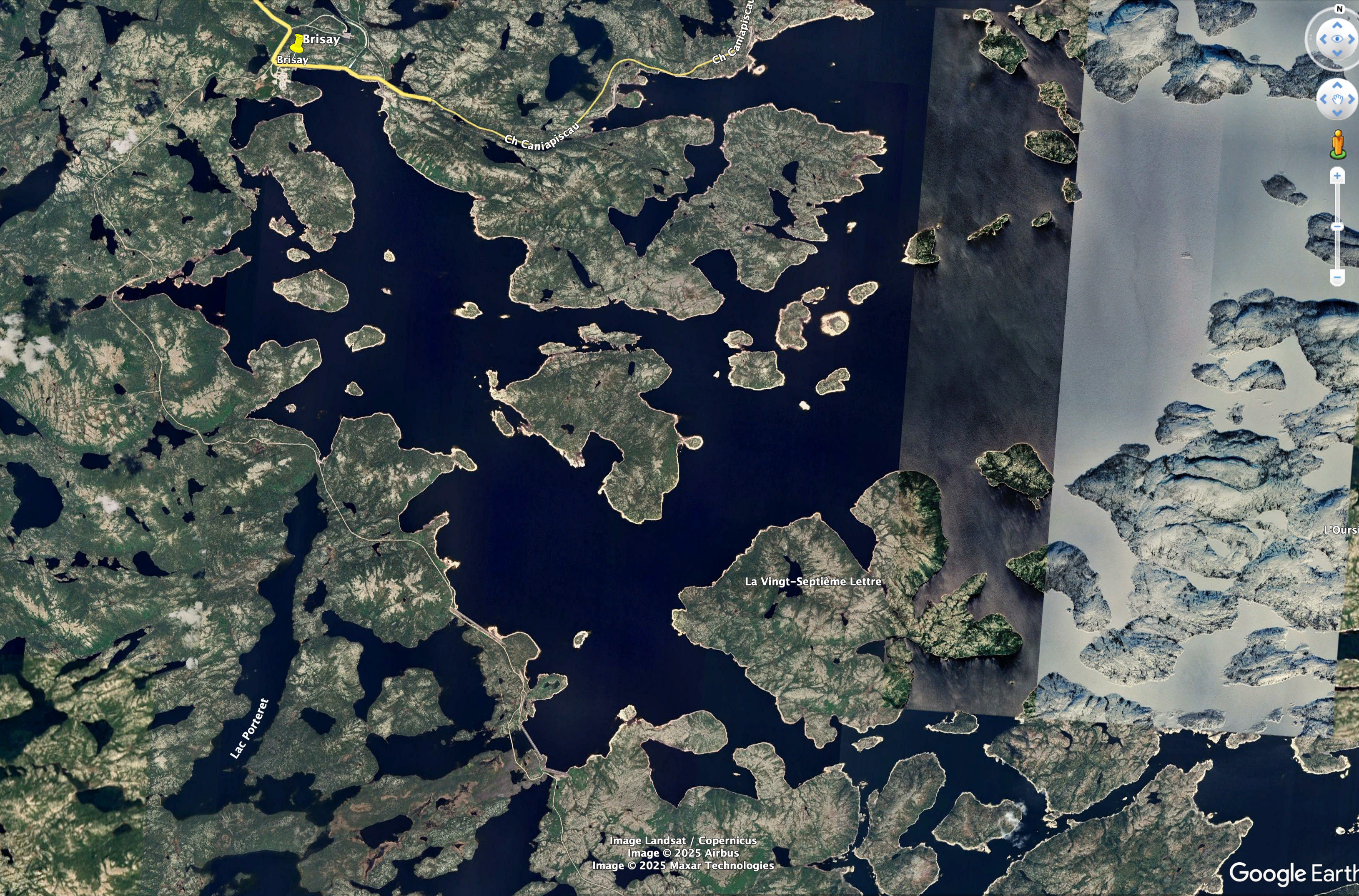
Late in the day of July 18th, I traveled the road along the west side of the Caniapiscau Reservoir. I would travel from Brisay to the lower center of the photograph to the site marked south culvert.
This shows the upper third of the drive, with the road now visible as a faint white line.
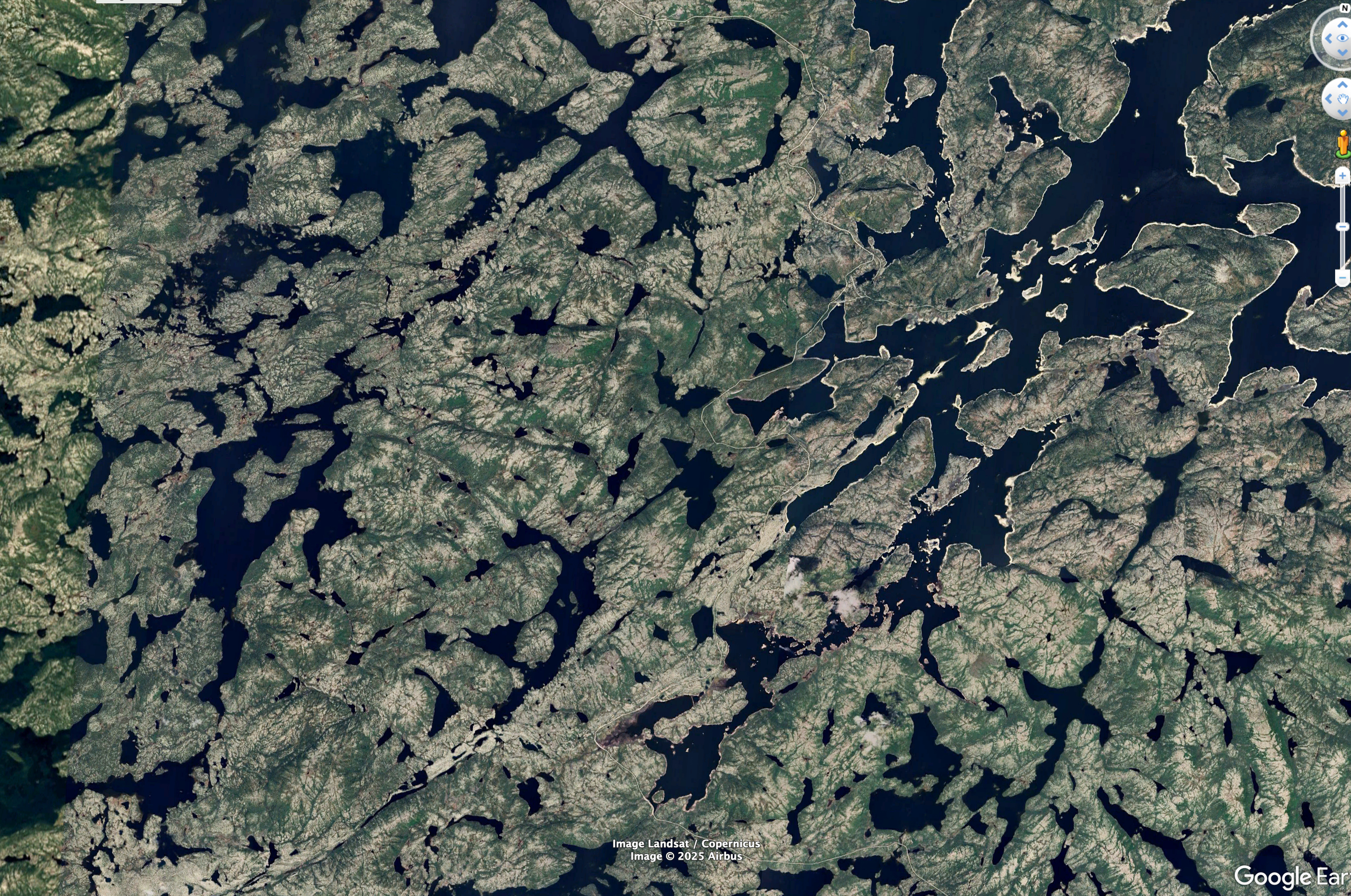
The middle third of the drive.
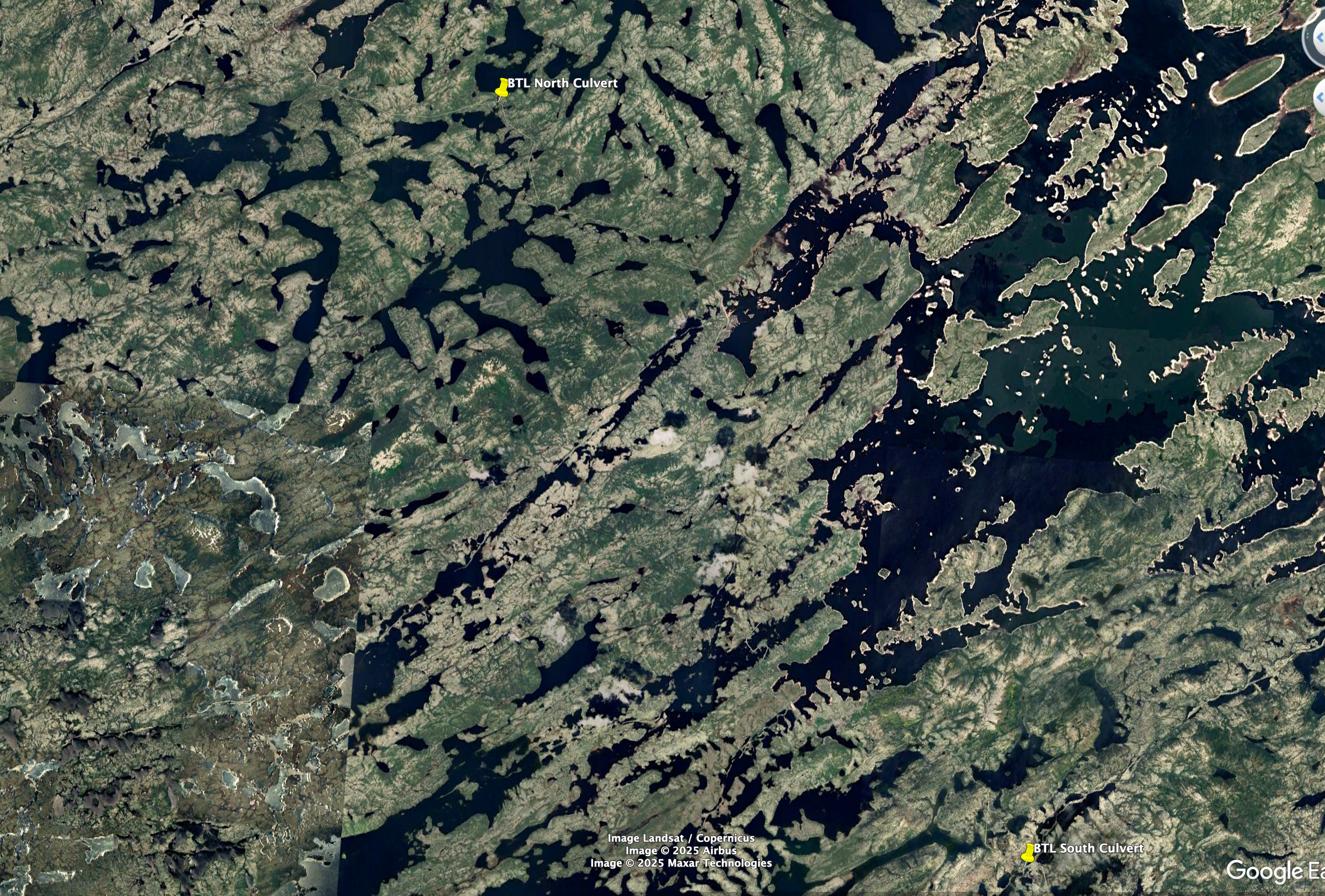
The end of the drive. I would fish this area with good success for Brook Trout and Lake Trout.
Several communication towers were present along the road.
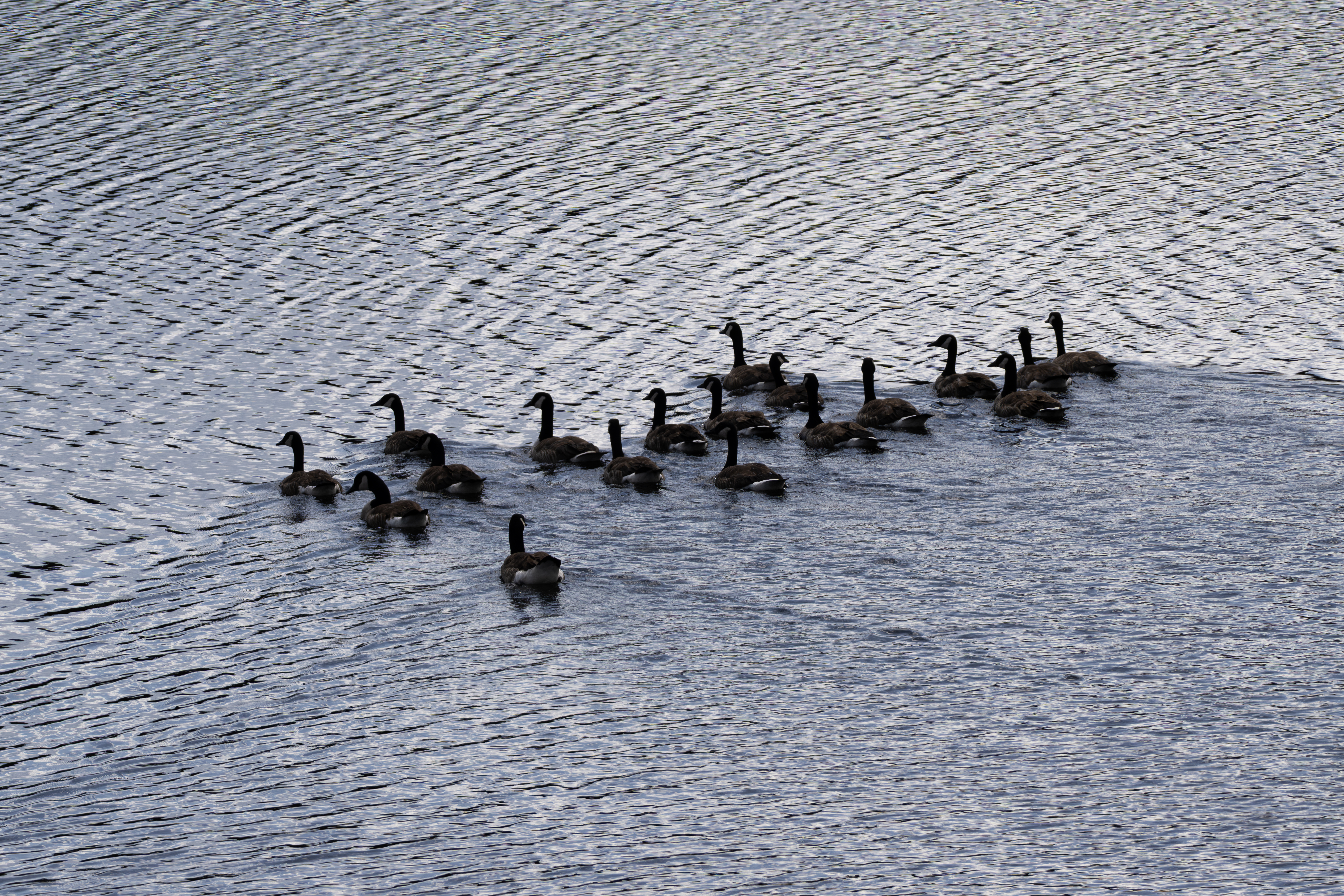
These Canada Geese were found in a bay of the reservoir close to Brisay.
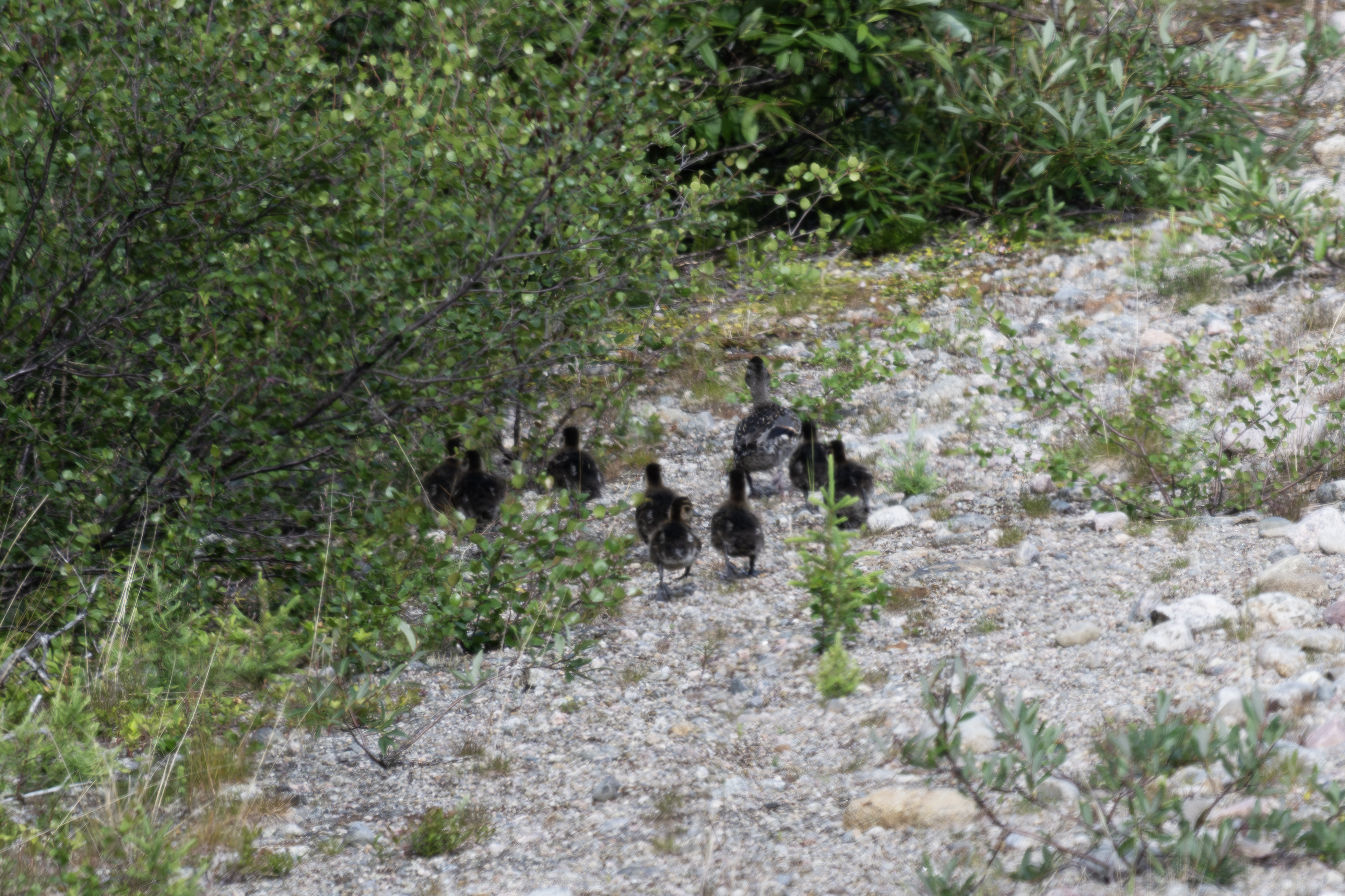
This momma duck and her crew were observed along the road near the north culvert.
The evening of July 20th I walked along the road for several kms.
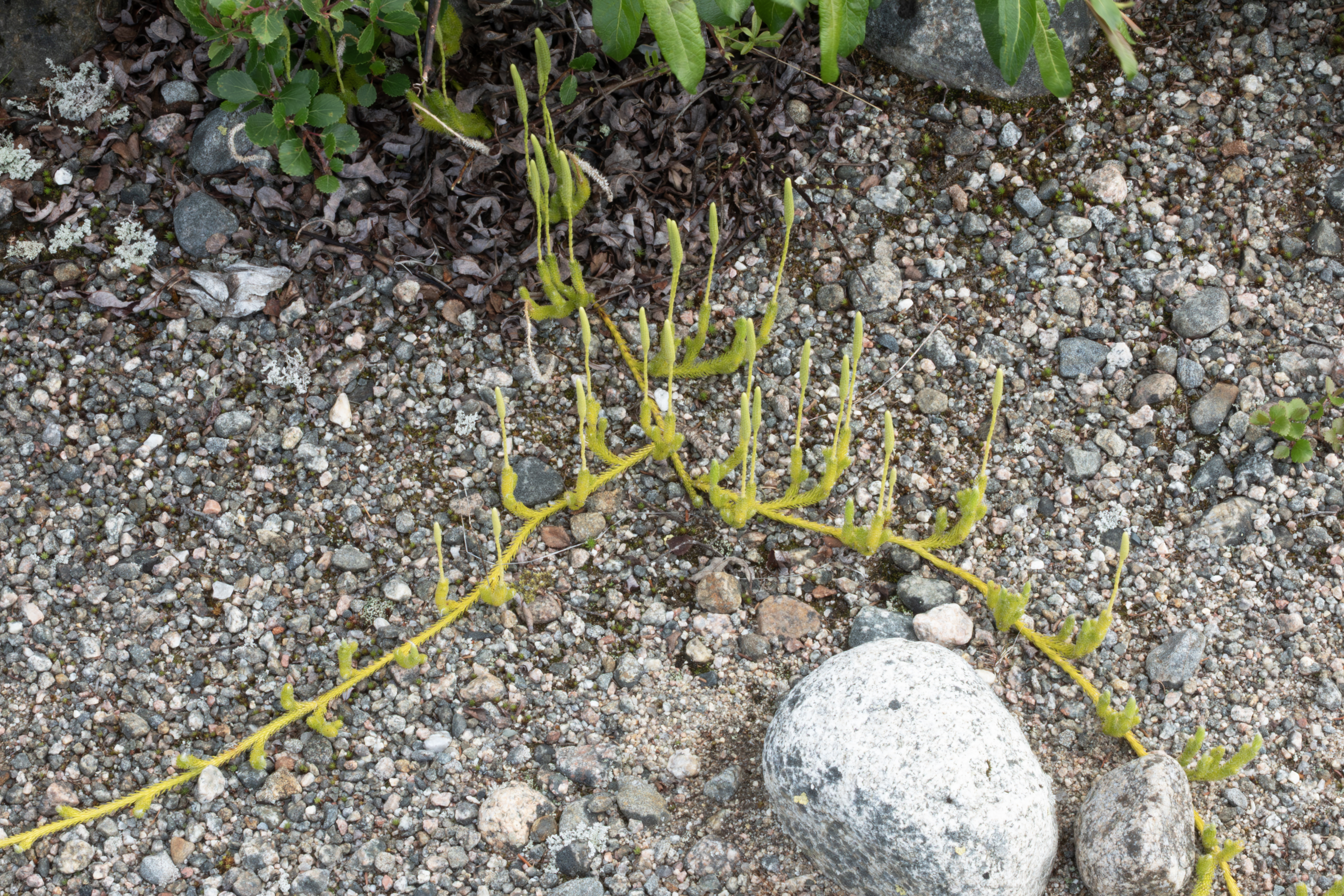
This is Arctic Stag's-horn Clubmoss (Lycopodium lagopus).
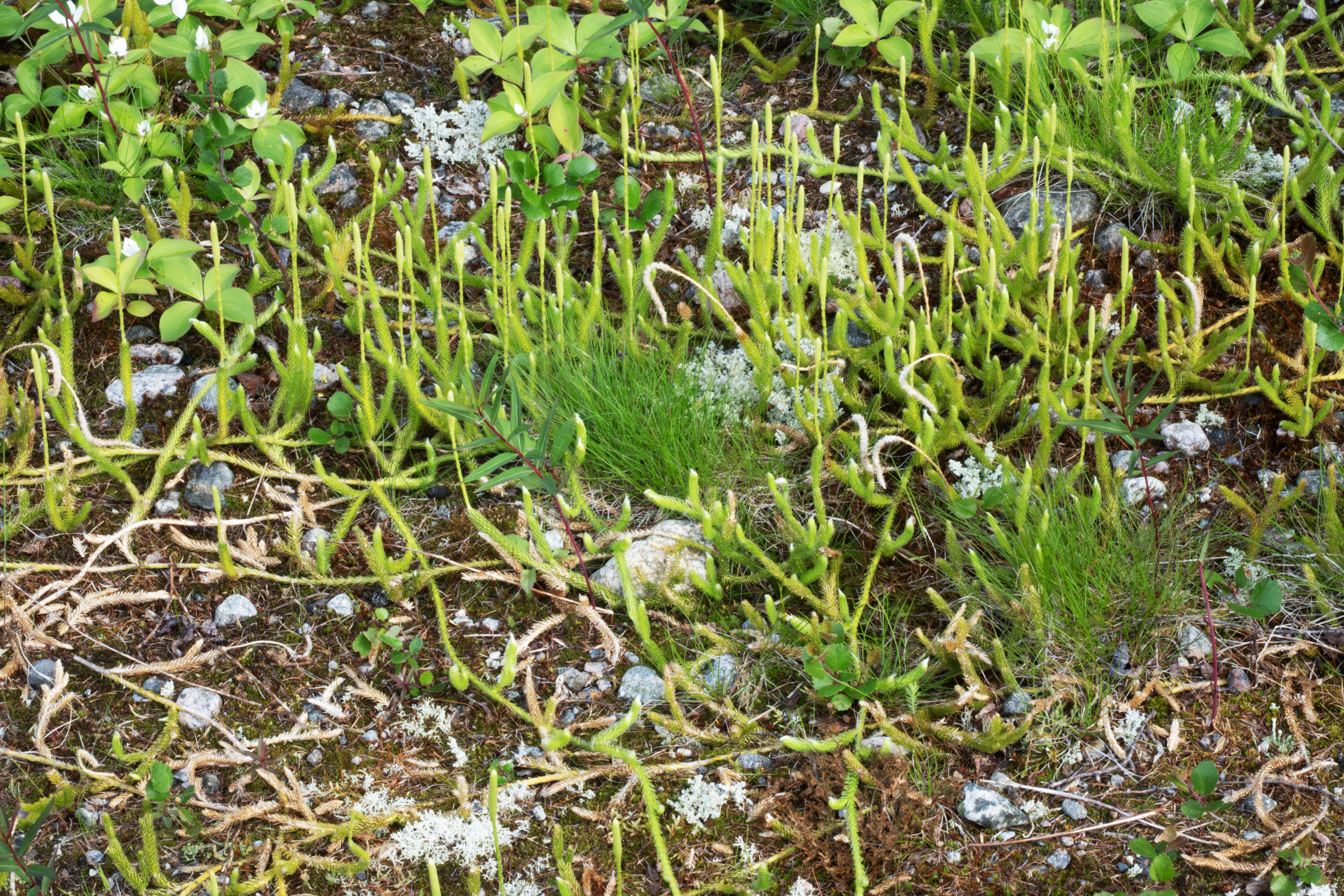
Another Lycopodium lagopus.
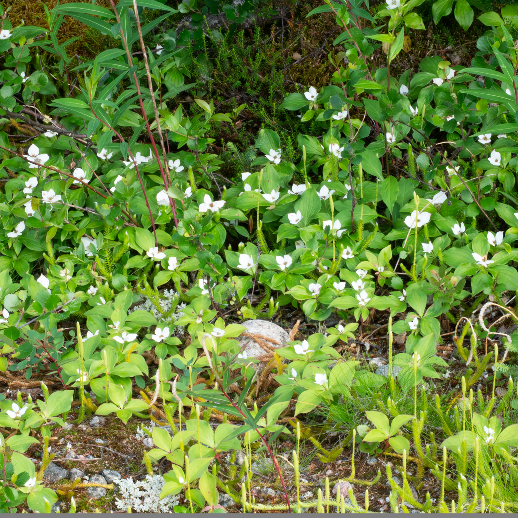
Canadian Bunchberry.
Spooked this Spruce Grouse into a tree.
Two nice Brook Trout taken from the north culvert. These always jumped during photo shoots and I was always looking at them.
Hundreds of levees along the reservoir system. Most access roads are closed, as for this one.
Just to the south, another levee.
I left the west side road of the reservoir the afternoon of July 21st and headed for Caniapiscau, the very east end of the road. A Common Loon.
Fished for dinner at a culvert about 10 km from the end of the road. I caught a 35 inch northern pike here in 2018.
Early the morning of July 22, I spied this grouse on a stump, visible in the middle of the photograph.
I took several close photographs.
Very cooperative.
Eyeing me carefully.
When I got too close, she flew into a spruce tree, and her young flew off. She had been standing guard.
After visiting Caniapiscau, I headed back west. Here is a shot of the crossing over the overflow channel.
The Brisay complex, viewed from the east side of the dam.
The reservoir as seen roadside at the overflow channel.
Brook Trout are found in the many stream crossings along the highway, just below rapids. The larger fish are just below the rapids, whereas the smaller ones are farther back.
The largest of the day.
July 25th, had to visit Radisson, and then returned to the highway.
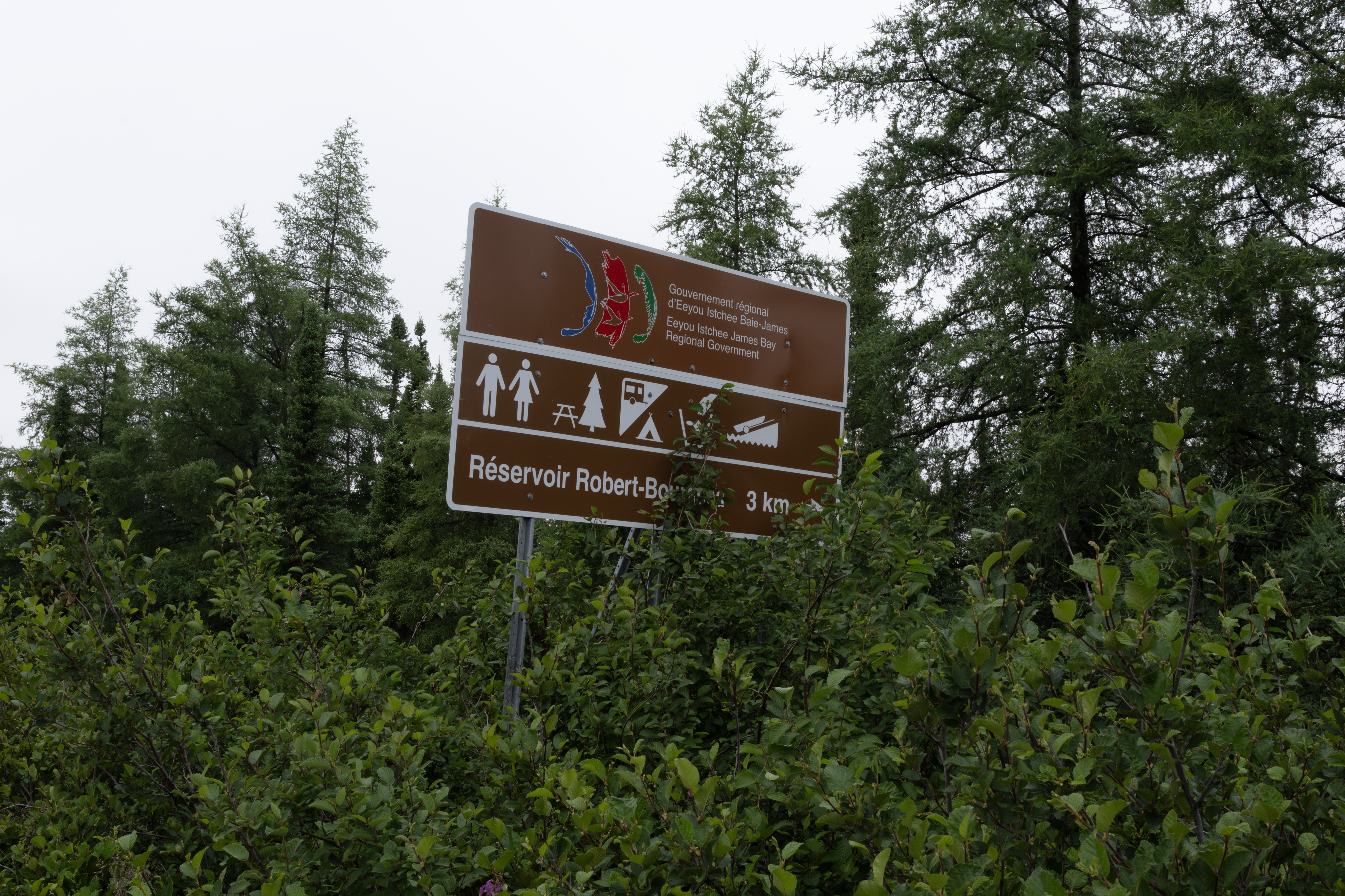
Returned to the Robert-Bourassa campground, here is the sign at the entrance from the highway. Initially the reservoir was known as La Grande-2, but was renamed after Robert Bourassa who, as Premier of Quebec (1970-1976 and 1985-1994), gave the James Bay Project a vital political impetus.
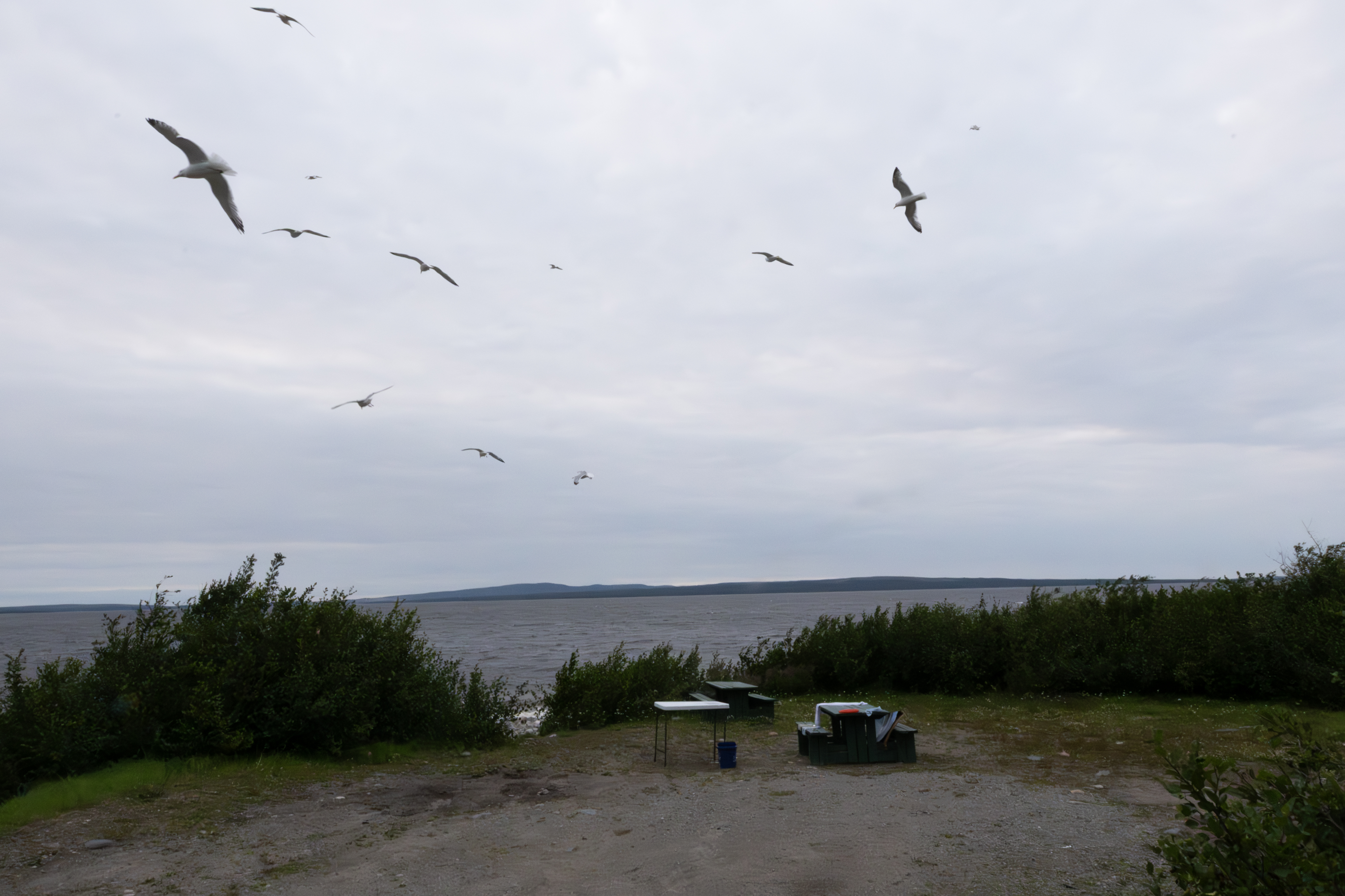
The gulls swarmed the site whenever I cleaned fish. Here is a shot showing about half of the 2 dozens birds.
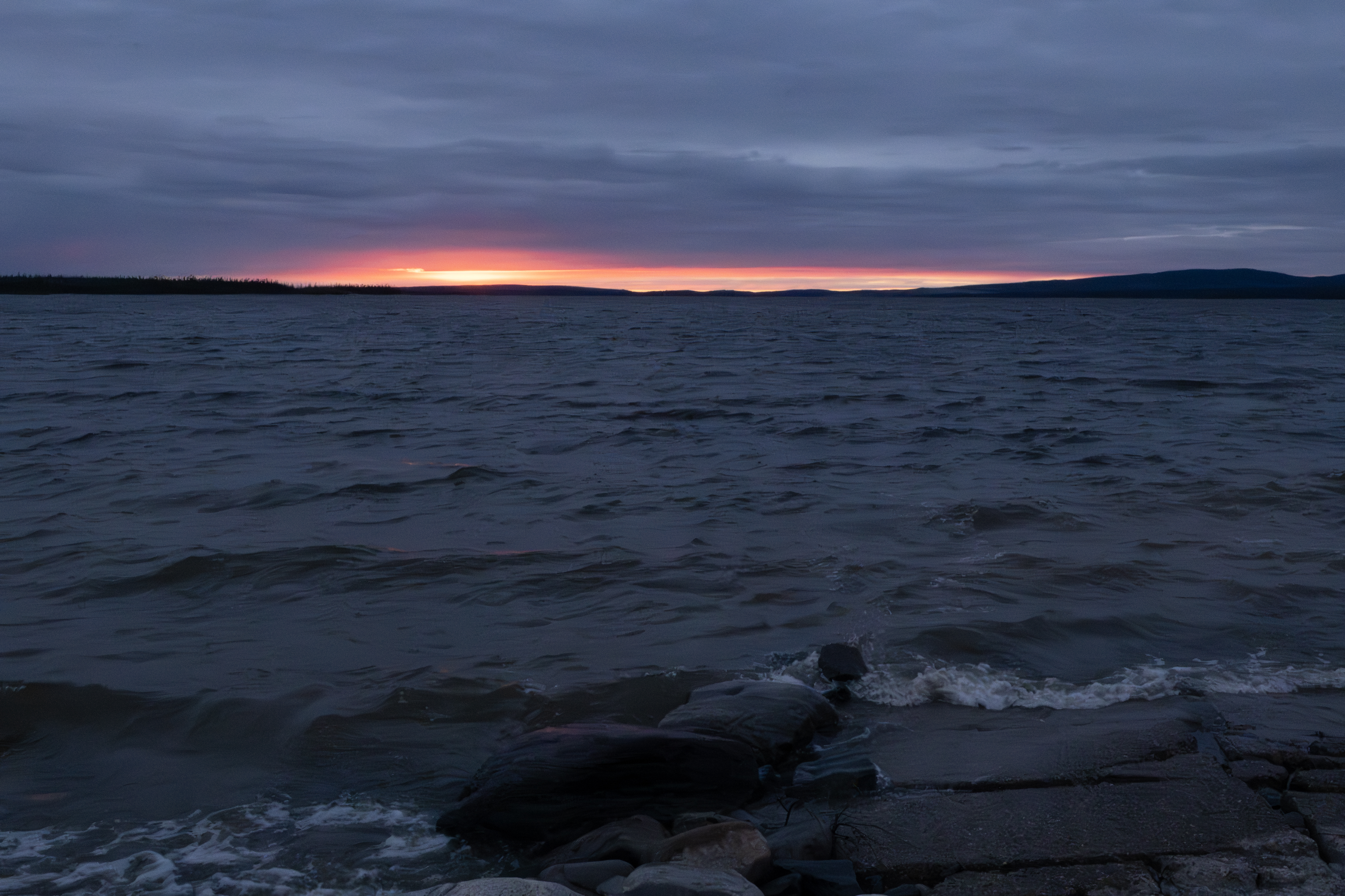
Sunset on the reservoir from the boat launch.
July 26th, headed east on the highway toward Brisay.
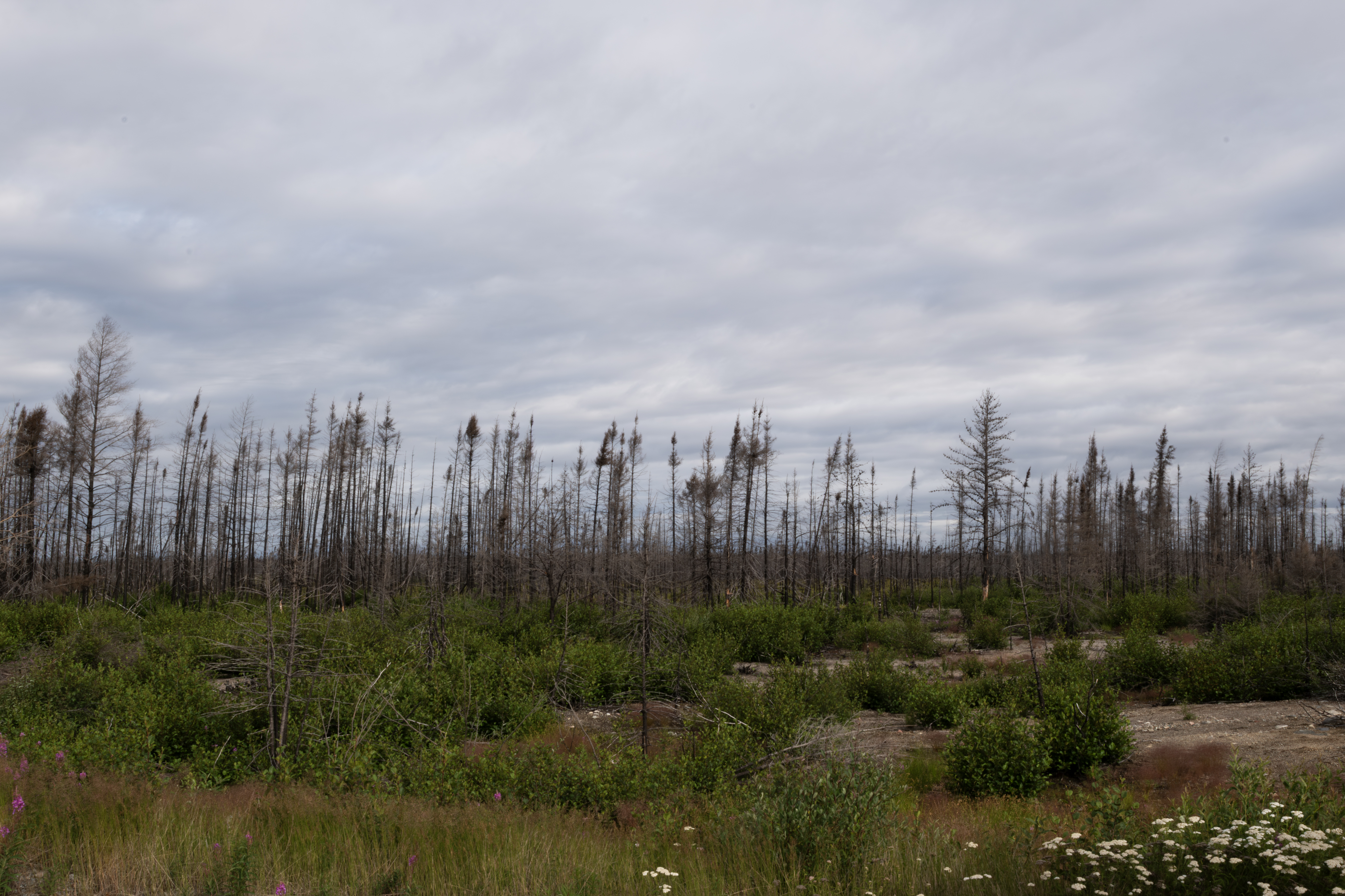
Much of the first few hundred kms suffered fire damage.
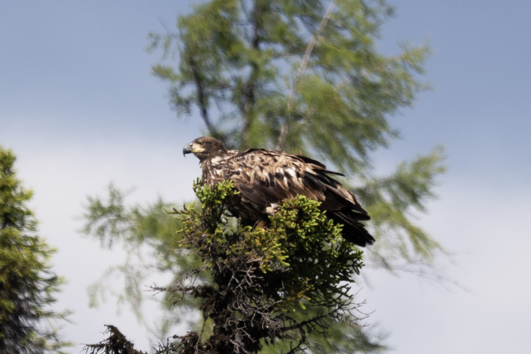
On the way to Brisay, saw this Bald Eagle.
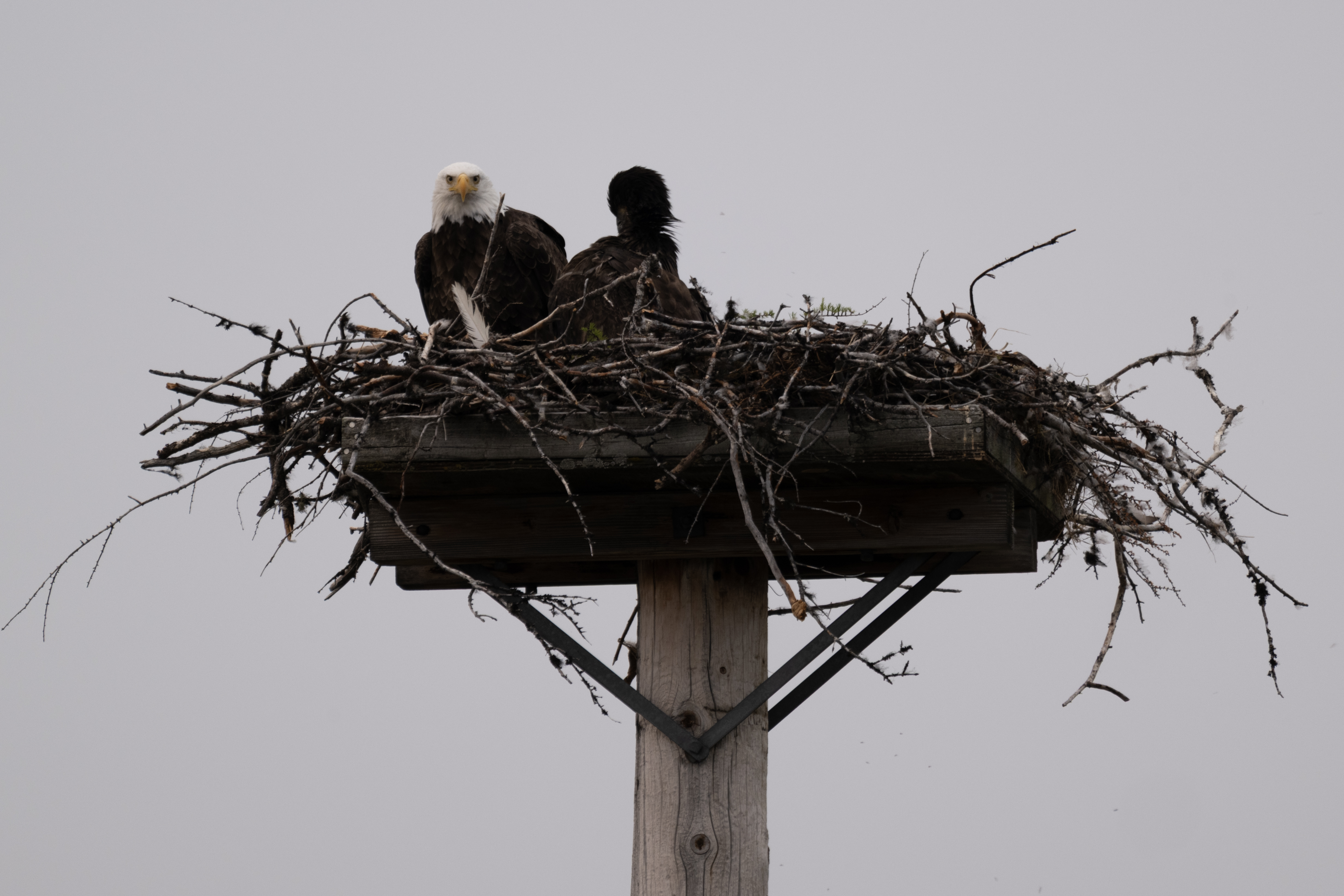
The Bald Eagle nest at the Brisay boat launch.
This is the end of Part A. Click here for Part B.
The trip overview. The total drive is about 3400 miles, with the last 500 or so on the Trans Taiga Highway (TTH), an improved primitive road that services four dams on the La Grande River. I left Henderson July 4th, stopped in Douglas Co., WI on July 6th, and Cook Co., MN July 7th. July 9th I stopped north of Geraldton, ON, July 10th Fraserdale, ON, and July 11th I made it to Route 1055, just east of Matagami, QC.
This Google Earth image shows all spots for which I collected Polygonia faunus, my target species for the trip, as well as several locations that I will reference in this post.
On July 7th, I walked along S. Fowl Road in NE Minnesota, a good spot for Polygonia. No fresh specimens were on the wing, in fact, most butterflies were delayed, ie, not flying on the date that they should have. This is toward the end of the road, a fen that crosses the road.
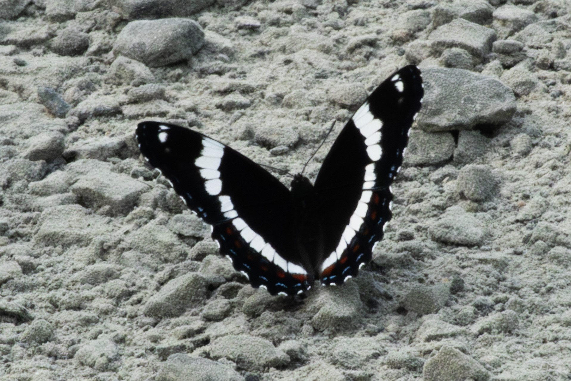
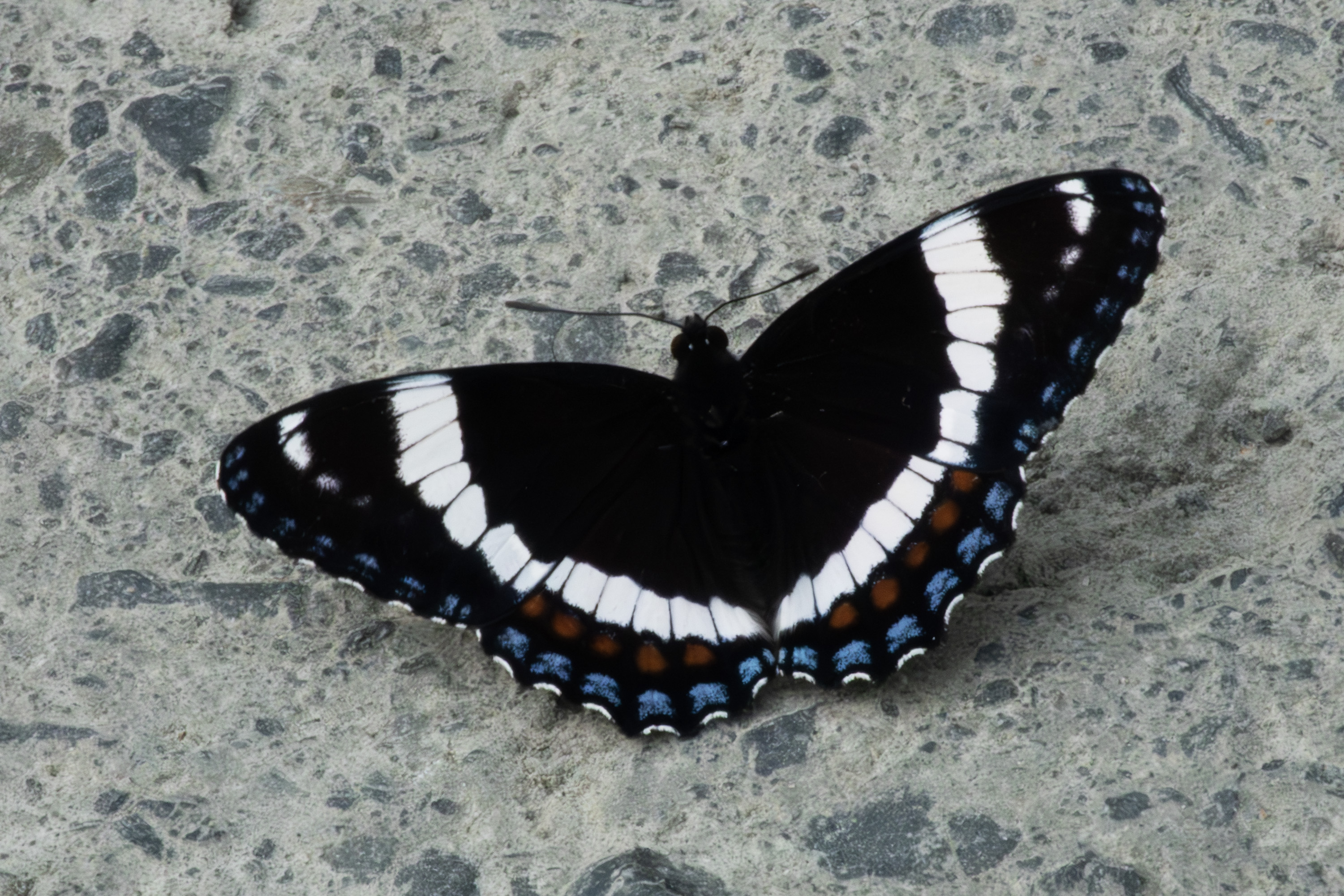
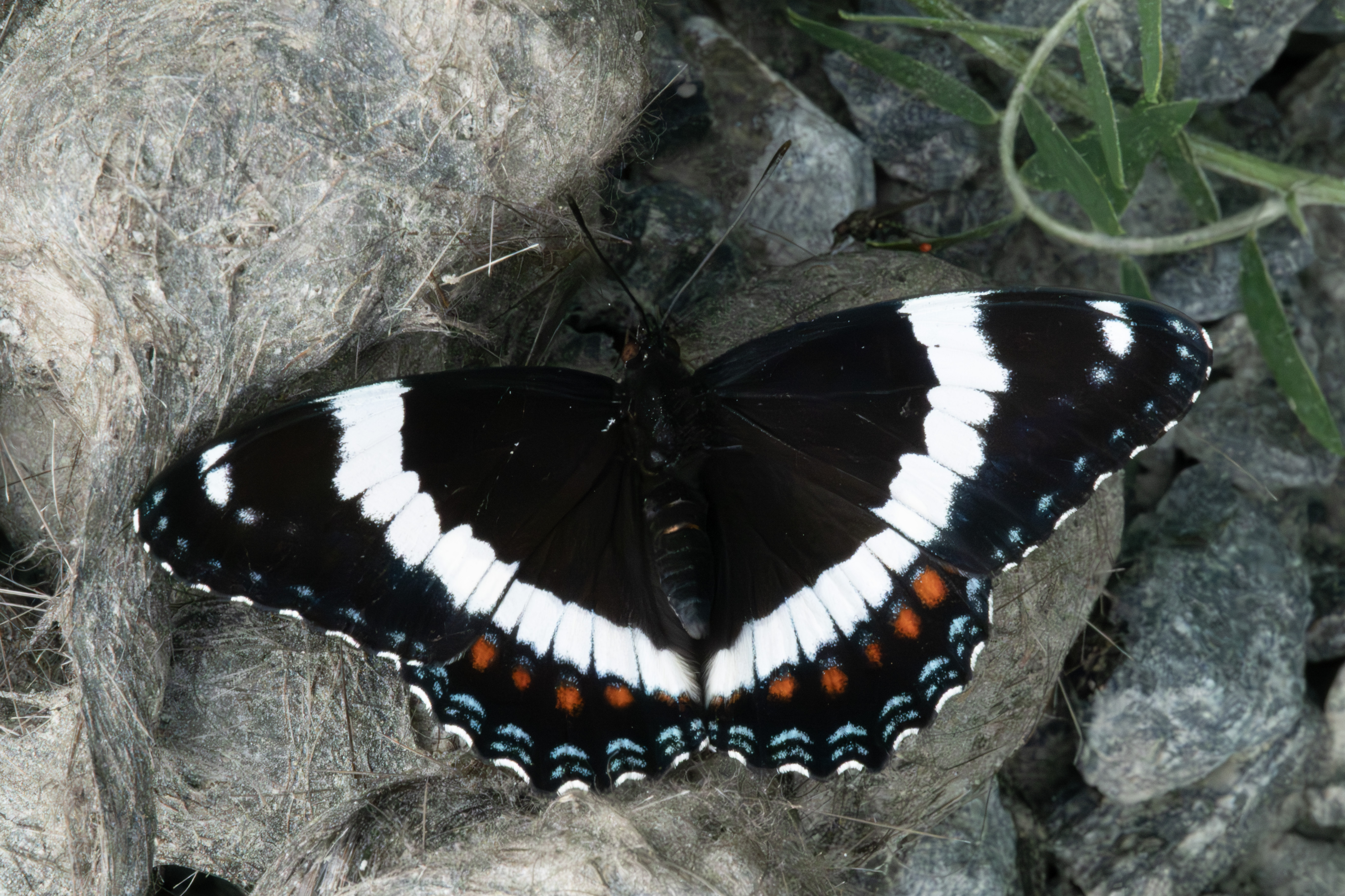
On July 10th, I visited Fraserdale, ON. This is a ghost town in eastern Ontario north of Smooth Rock Falls. The logging roads are good butterfly habitat, and many were on the wing today. This is Limenitis arthemis arthemis, often abundant the first 2 weeks of this trip.
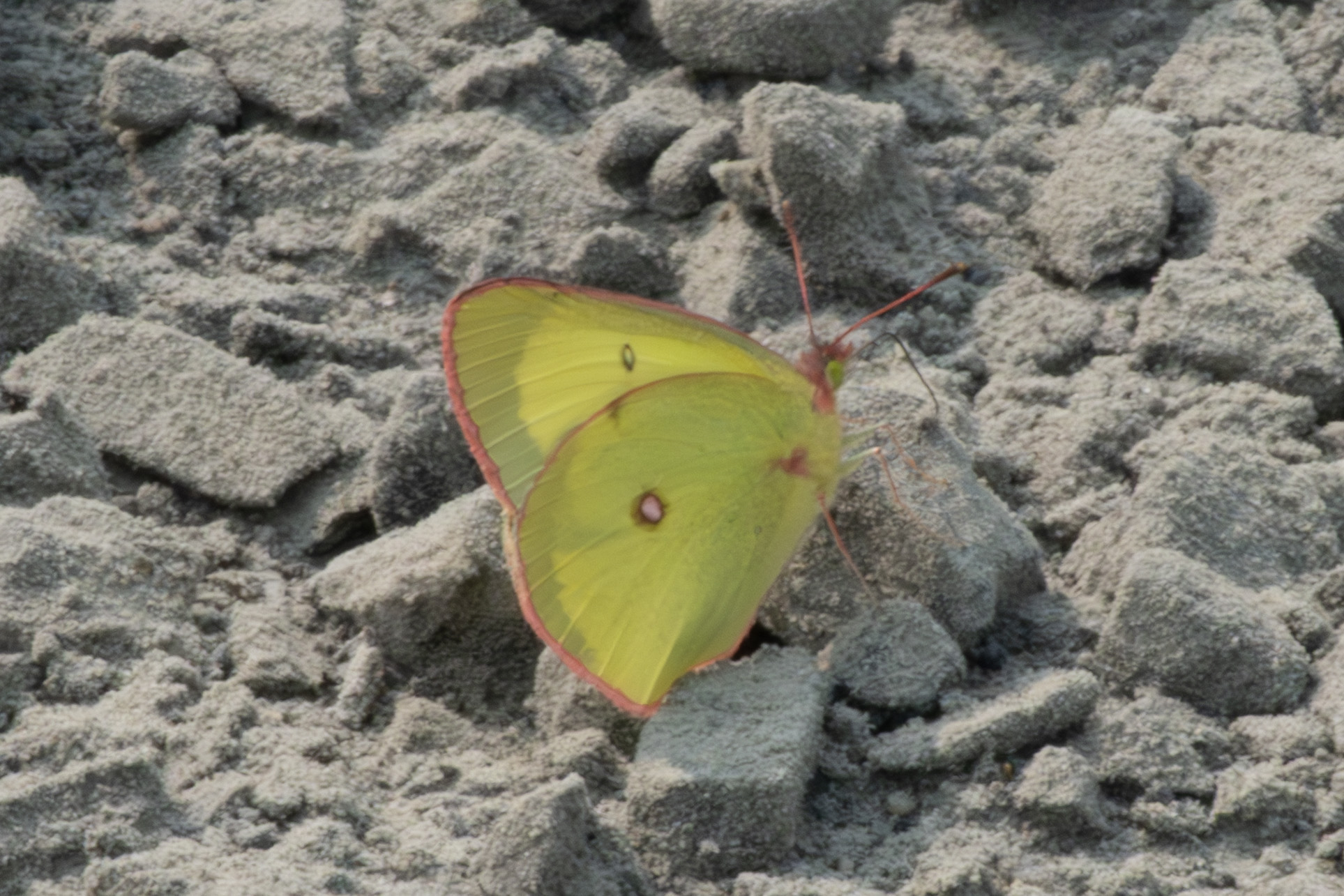
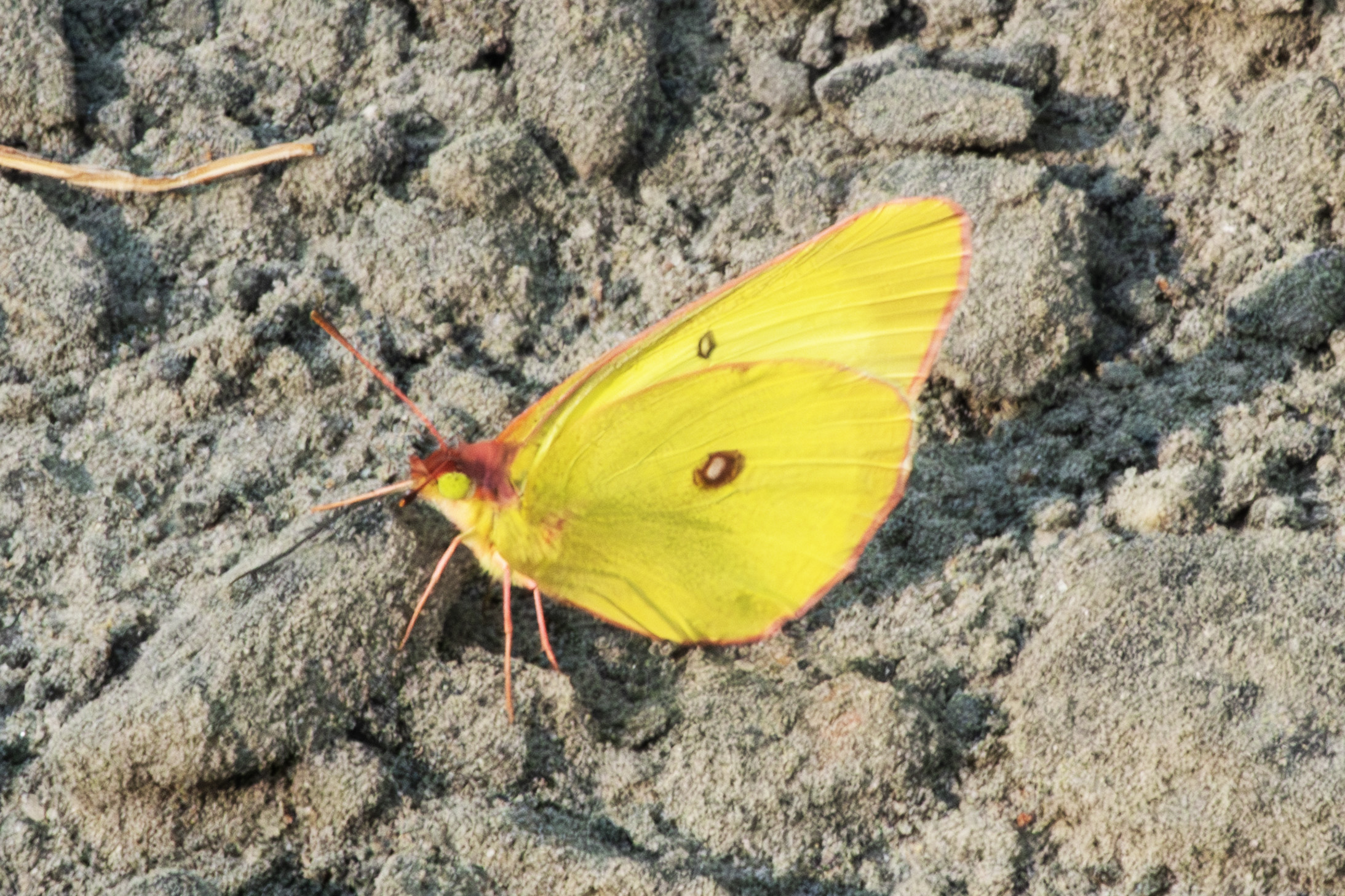
On July 11th, I walked Route 1055 just west of the access road to the large gravel pit. A Colias interior.
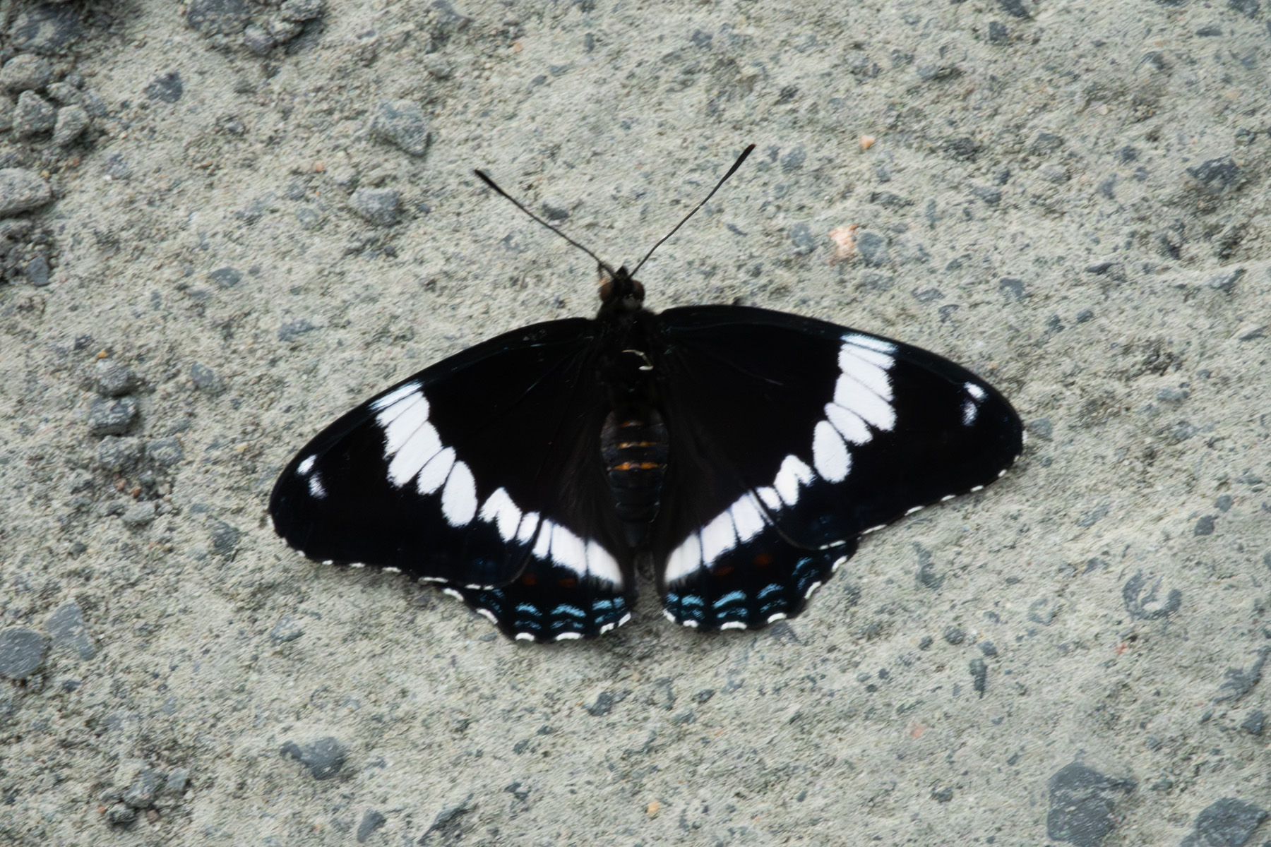
Another L. arthemis.
Another C. interior. This one is lying on the road to maximize exposure to the sun, as this was late in the afternoon.
This is Coenonympha california tullia, also sunning itself.
Another L. arthemis. These show some variabilty in the patterns, especially the banding along the lower hindwing.
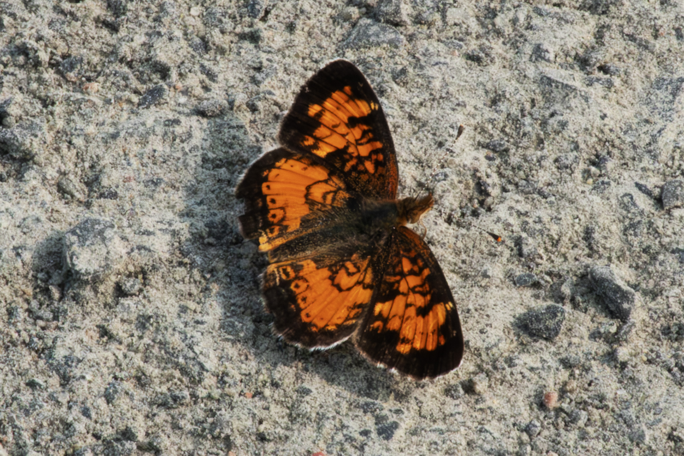
Phyciodes cocyta. Usually quite common, but rather spotty on this trip.
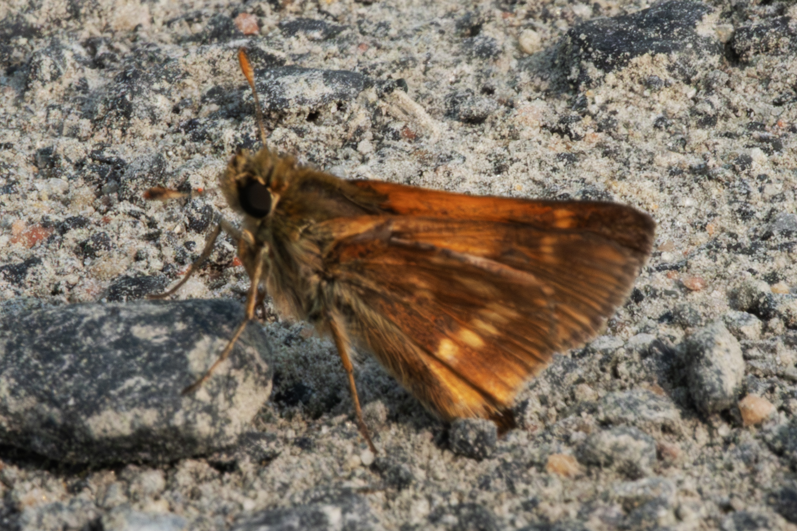
A Limochores mystic.
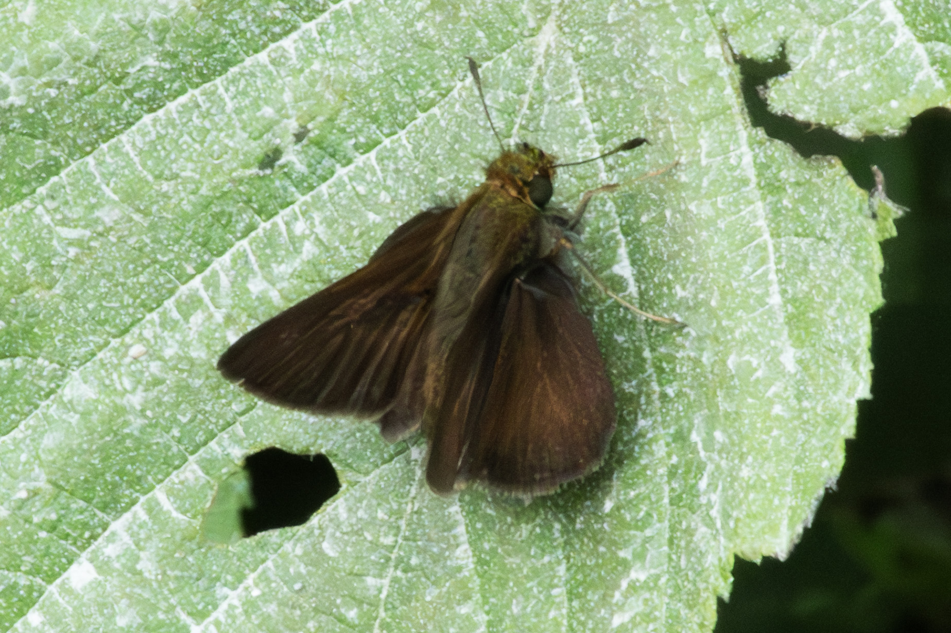
This is Euphyes vestris metacomet. BTW, for you non-butterfly folks, when I list 3 words for the name the third is the subspecies.
Another L. arthemis. Note that this specimen has red banding along the lower hindwing - compare to the previous photograph.
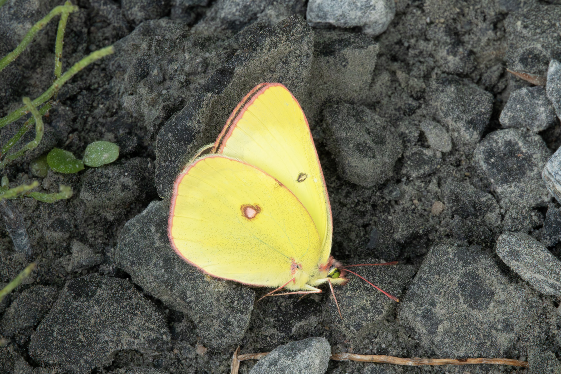
Another C. interior.
Another L. arthemis.
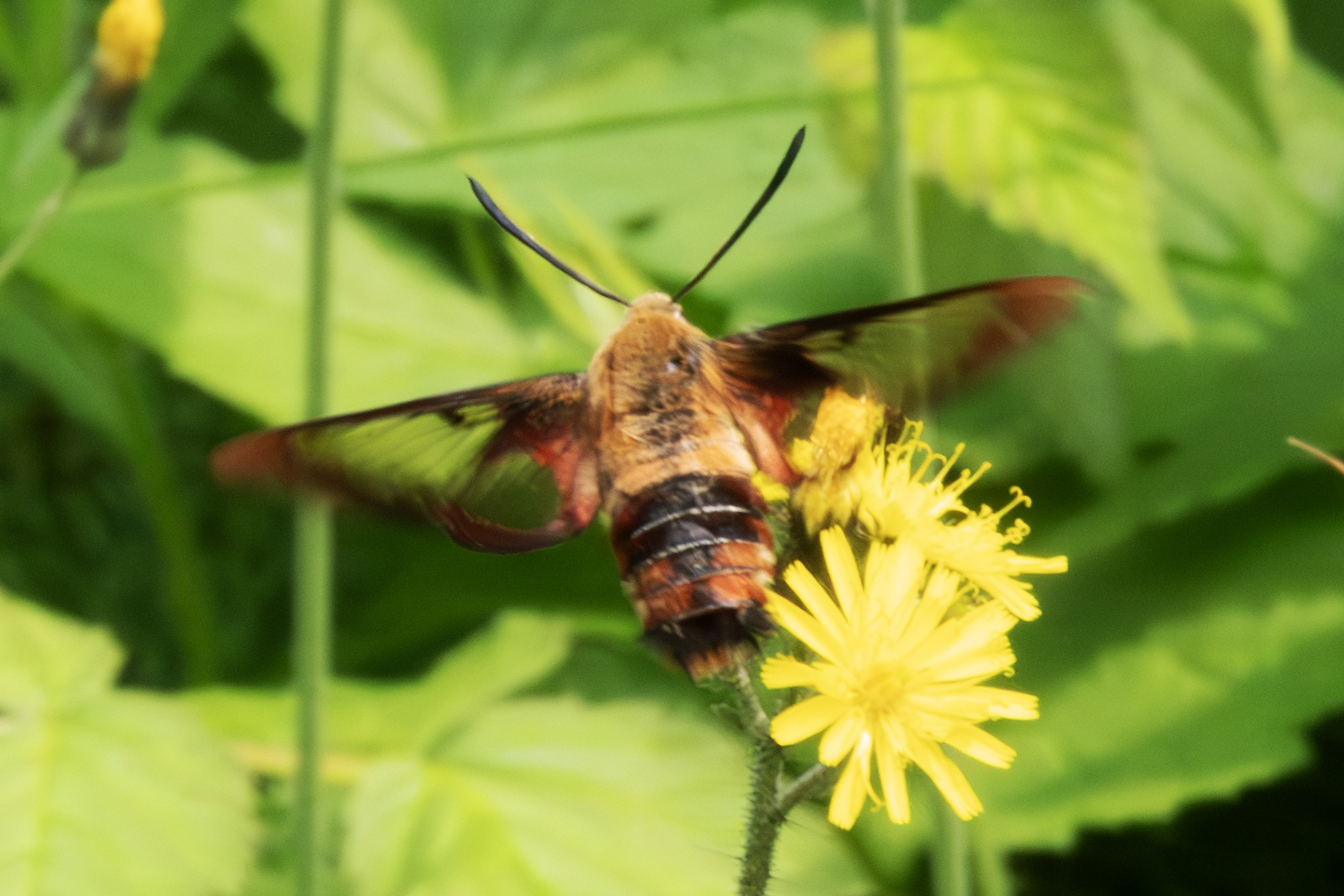
This is a Hummingbird Moth, Hemaris thysbe.
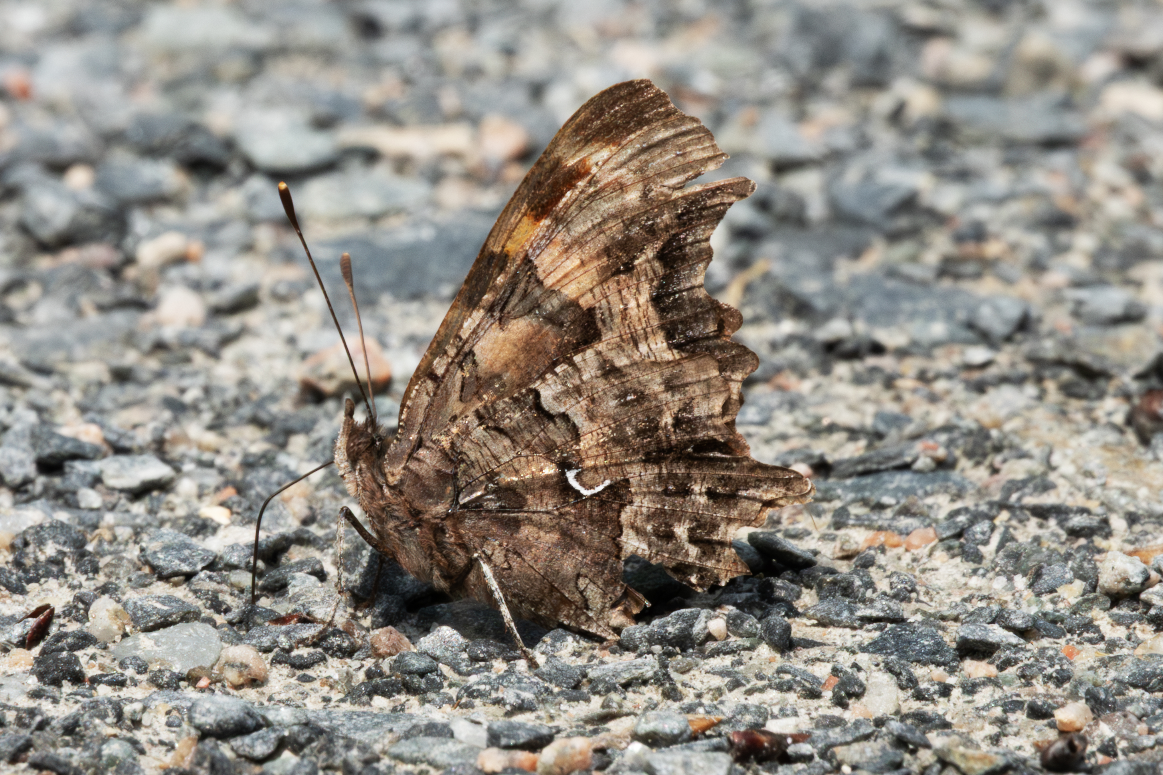
This is a very old and worn Polygonia faunus faunus, my target species. This one is almost a year old, as these emerge in August, hibernate in early September, and fly and lay eggs in the spring. I would return here August 14th to collect fresh specimens.
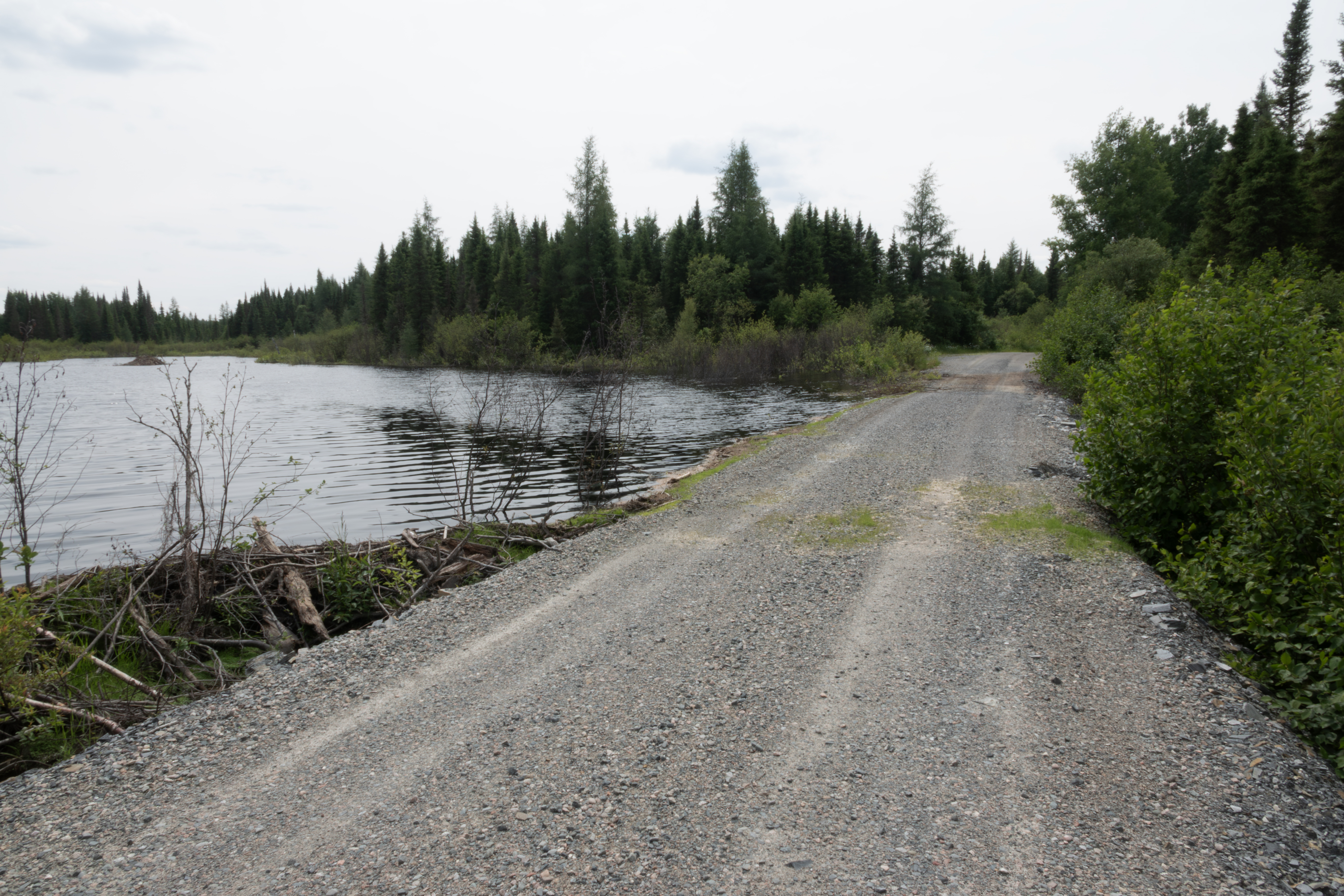
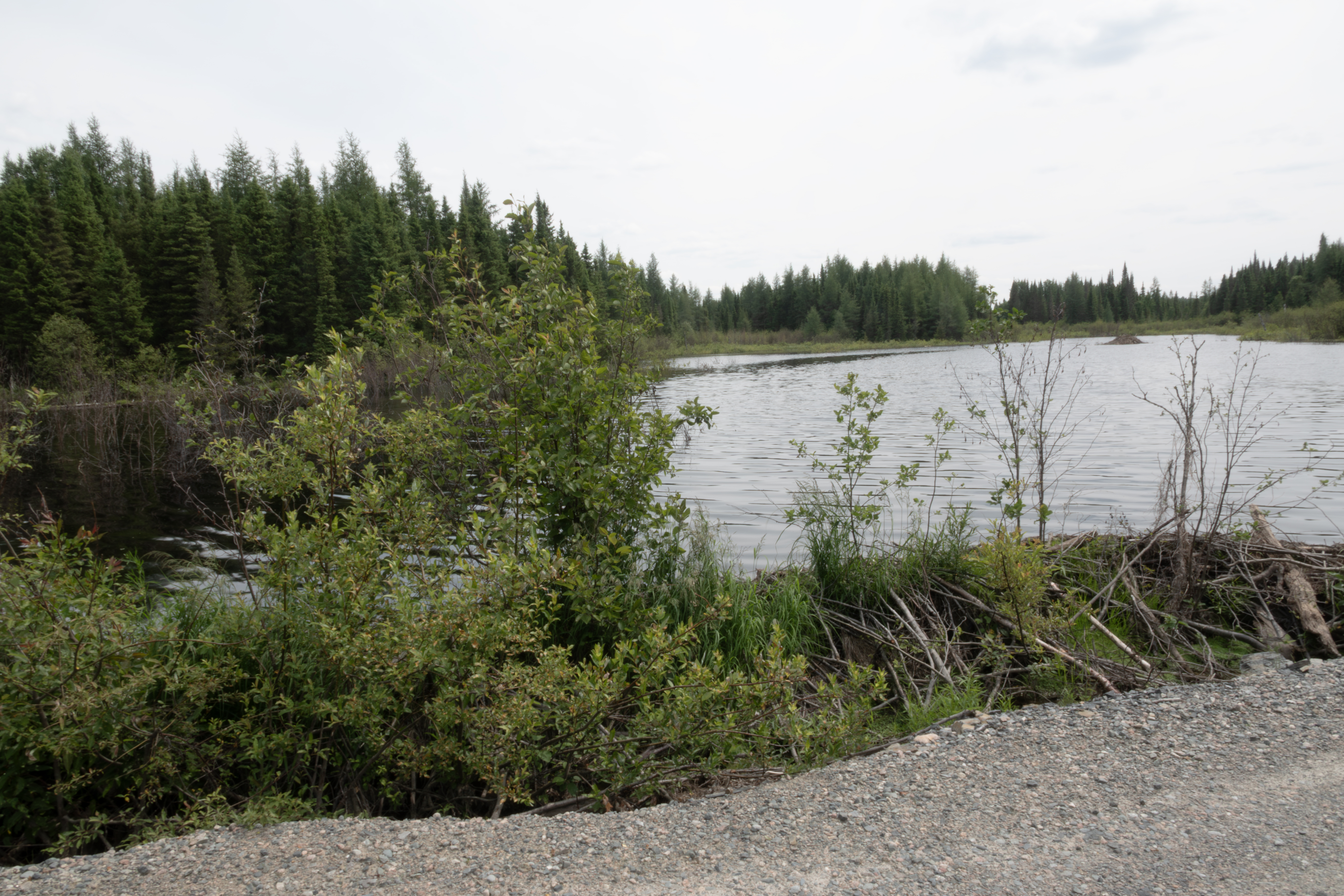
Beavers routinely dam the fen crossing this access road. Some years the dam is present, and some years not.
Looking toward the lodge.
The drainage end of the dam.
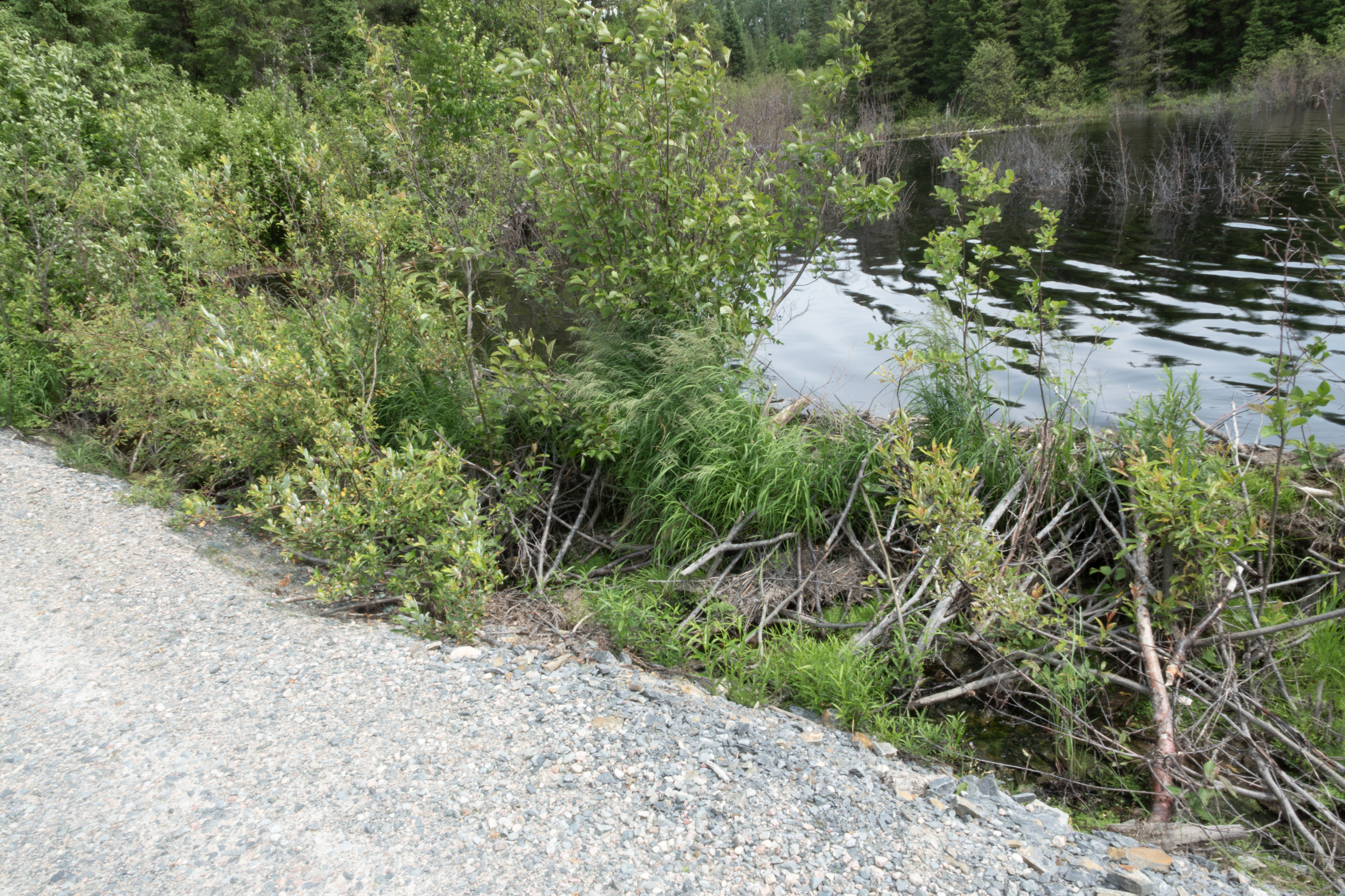
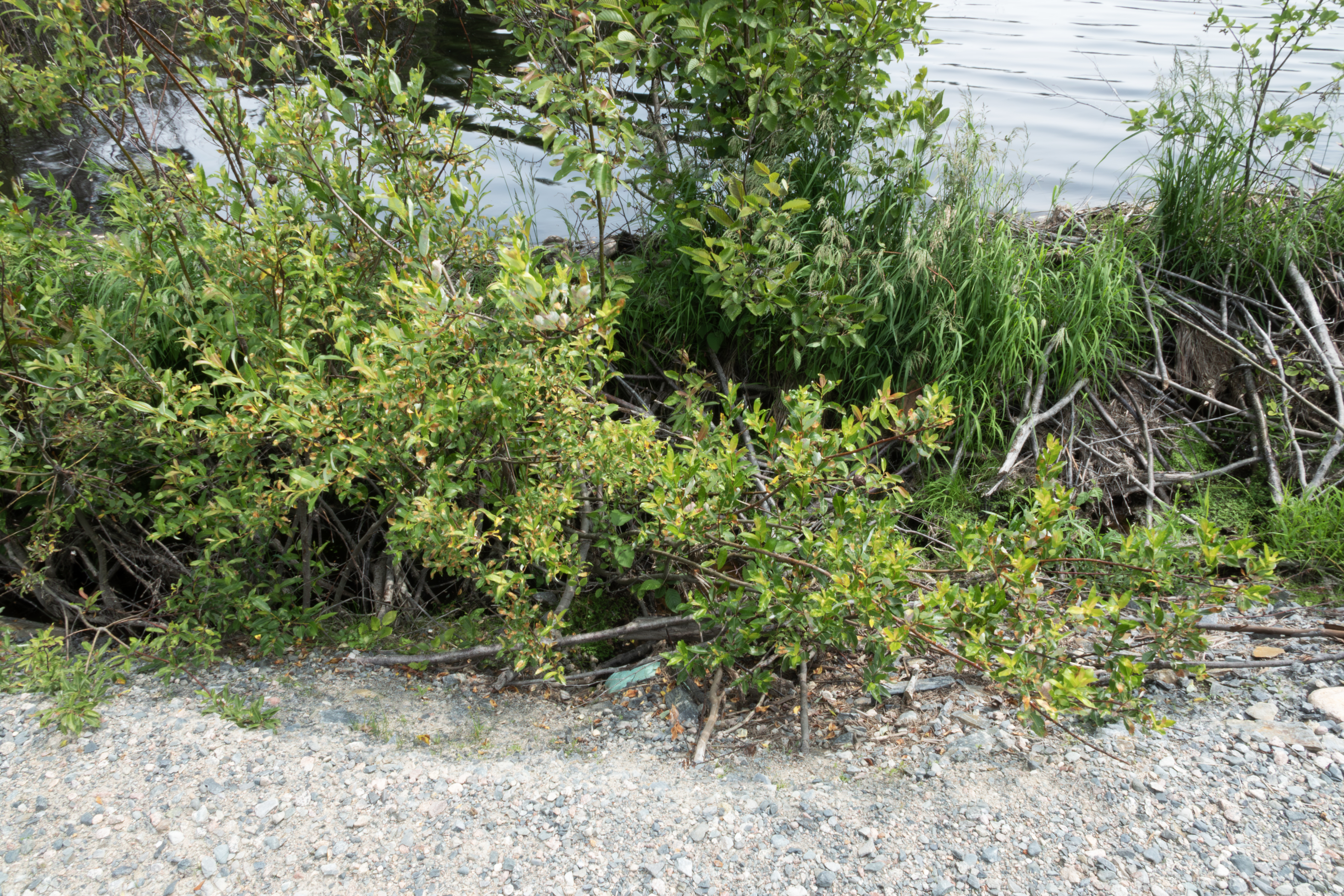
A closer view of the dam. These have younger plants and serve as good hosts for Polygonia larvae, especially Polygonia satyrus.
The lodge.
Speyeria atlantis atlantis, very fresh.
Another photograph.
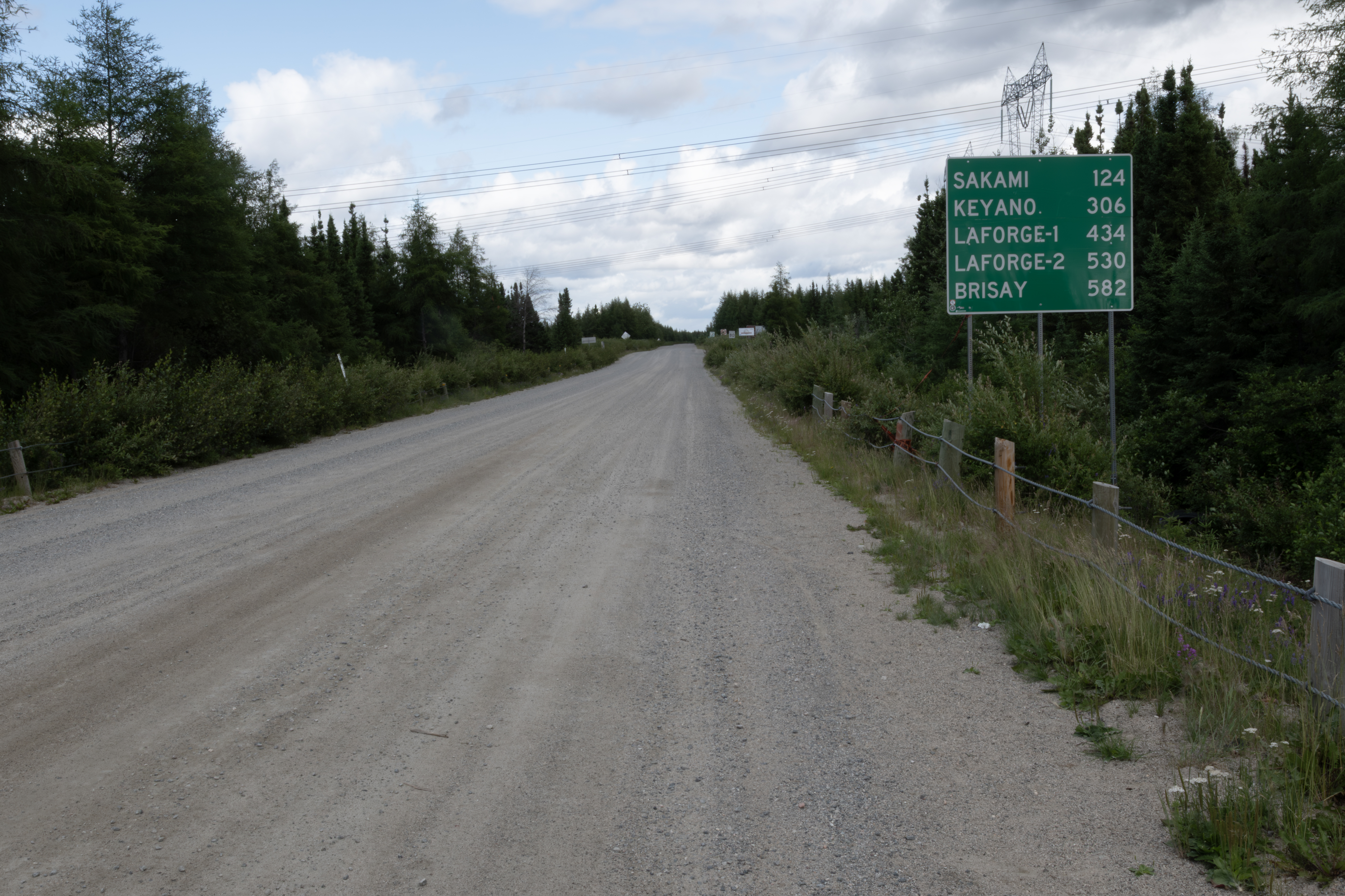
This is an overview of the gravel pit location, located halfway between Matagami and Quivillon. Matagami is just a few kms south of the start of the James Bay Highway, which I will drive the next two days to access the Trans Taiga Highway.
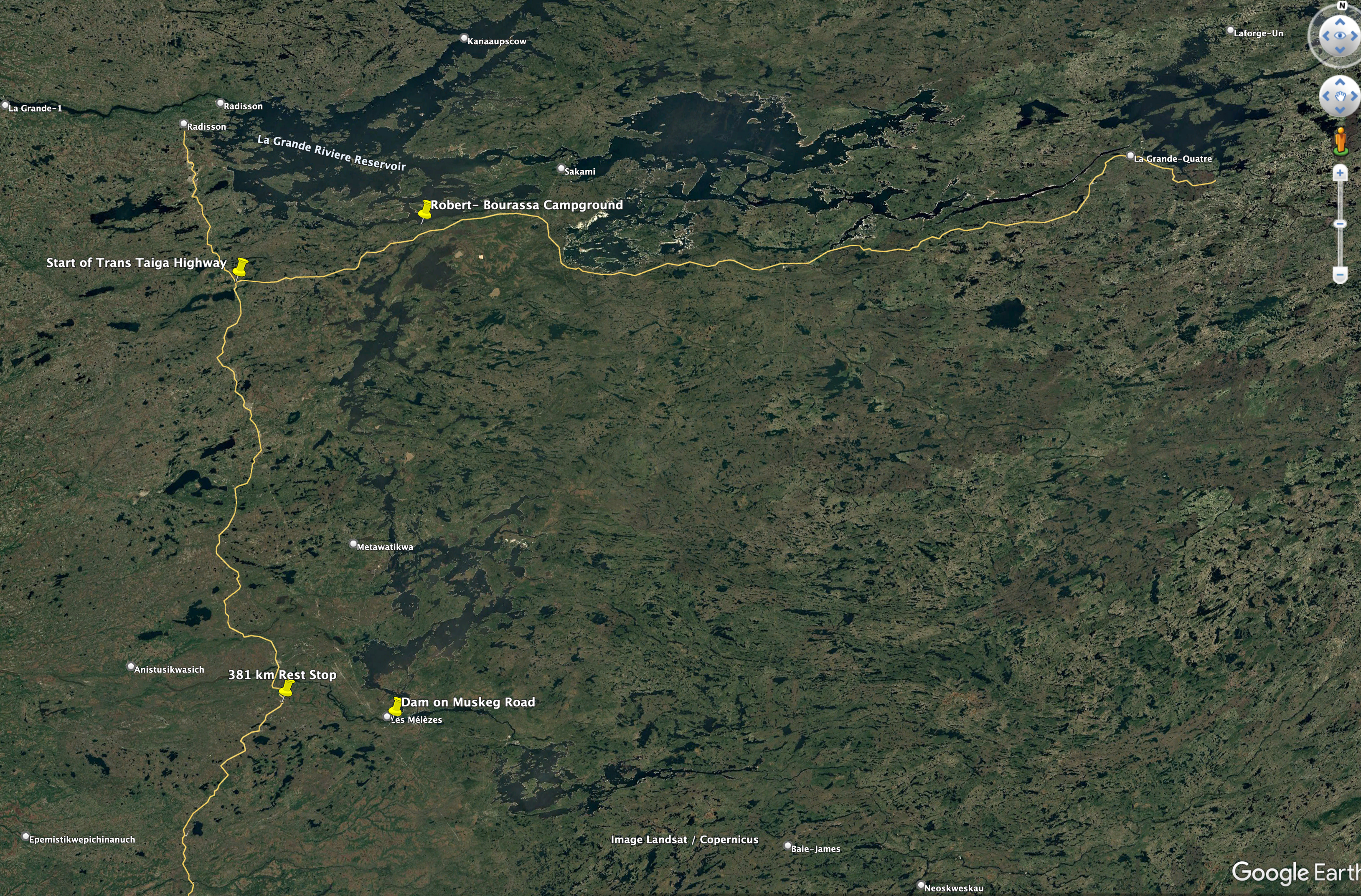
This is an overview of the distance from Matagami to Radisson and the start of the Trans Taiga Highway.
The 381 km rest stop is the only gas station on the route, and offers free showers and a restraunt.
This shows the northwest portion of the drive. Radisson is about 75 kms from the Trans Taiga Highway. No gas at this intersection, so one must plan either a stop in town or one at the outfitter at 358 km on the TTH. The large bodies of water are reservoirs 2, 3, and 4 from right to left.
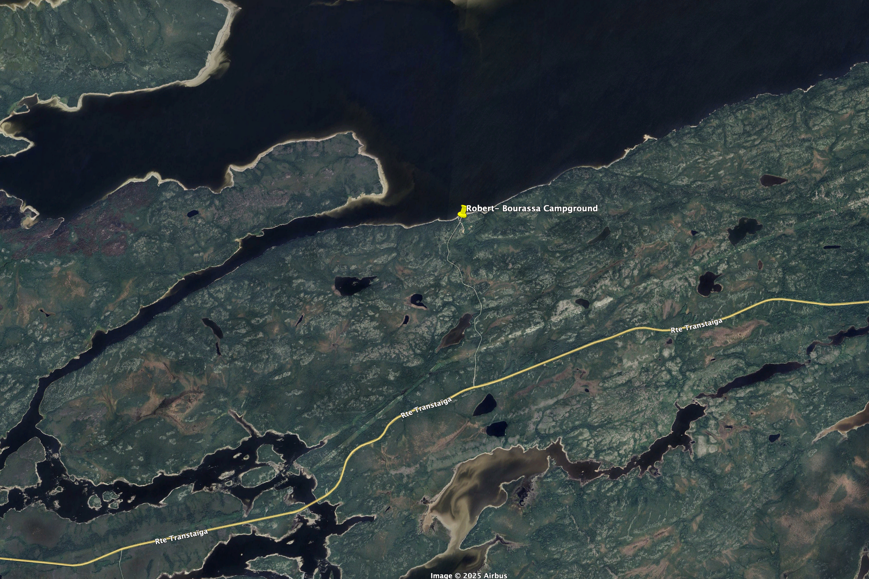
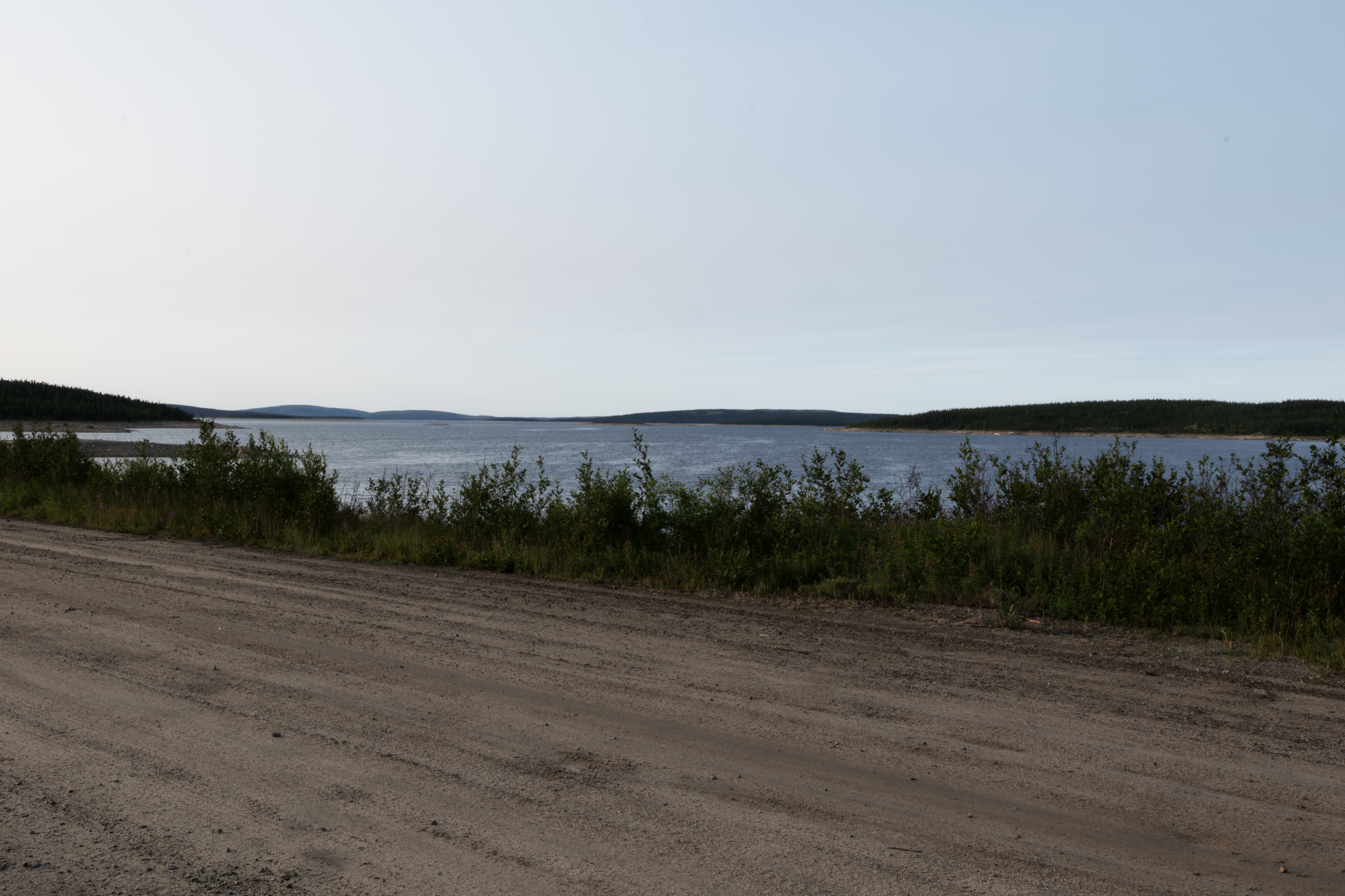
This is the campground I stayed several times on the trip. Good fishing for northern pike at the point just to to left of the campground. The walleye spot is along a inlet to the Sakami River, just a 10 minute hike from a rest stop at 61 km. The access road is at 62 km. I would collect butterflies here several times, including P. faunus August 9-12.
A sample turbine, located in Radisson.
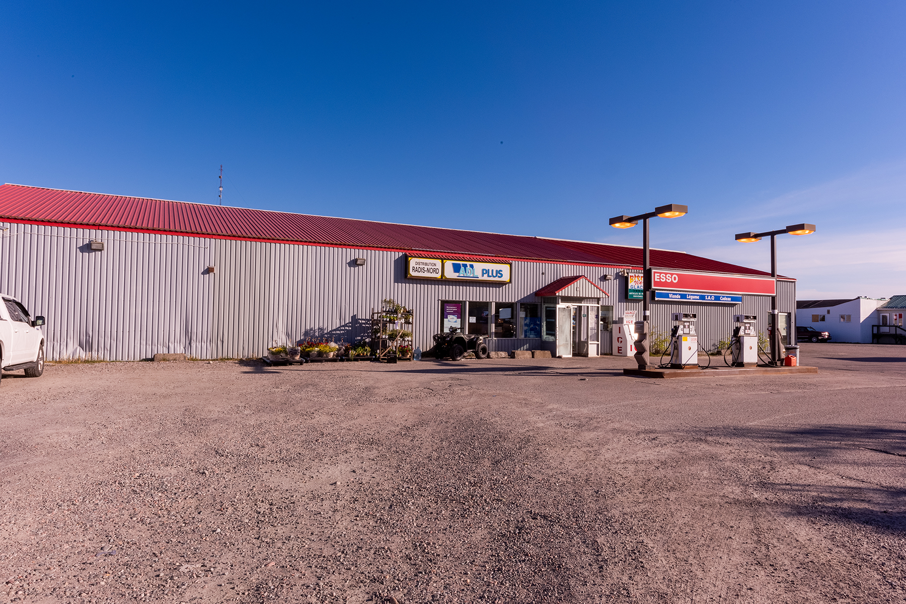
On July 16th, I stopped at the 358 Mirage Outfitter for gas, and then just east on the highway stopped at this beach for a bird bath.
I fished a culvert at this spot, which are usually good for northern pike, but had no luck.
Just to the left of the previous photograph.
Just to the left of the previous photograph.
Looking east at 480 km.
A river crossing about 30 miles east of Brisay.
Cree have many camps along all roads in the north. Here is one example. They spend about 7 months at these.
Nice scenery shot.
This C. interior was laying flat on the taiga to absorb sunlight.
These C. interior were feeding on mushrooms.
Another river crossing.
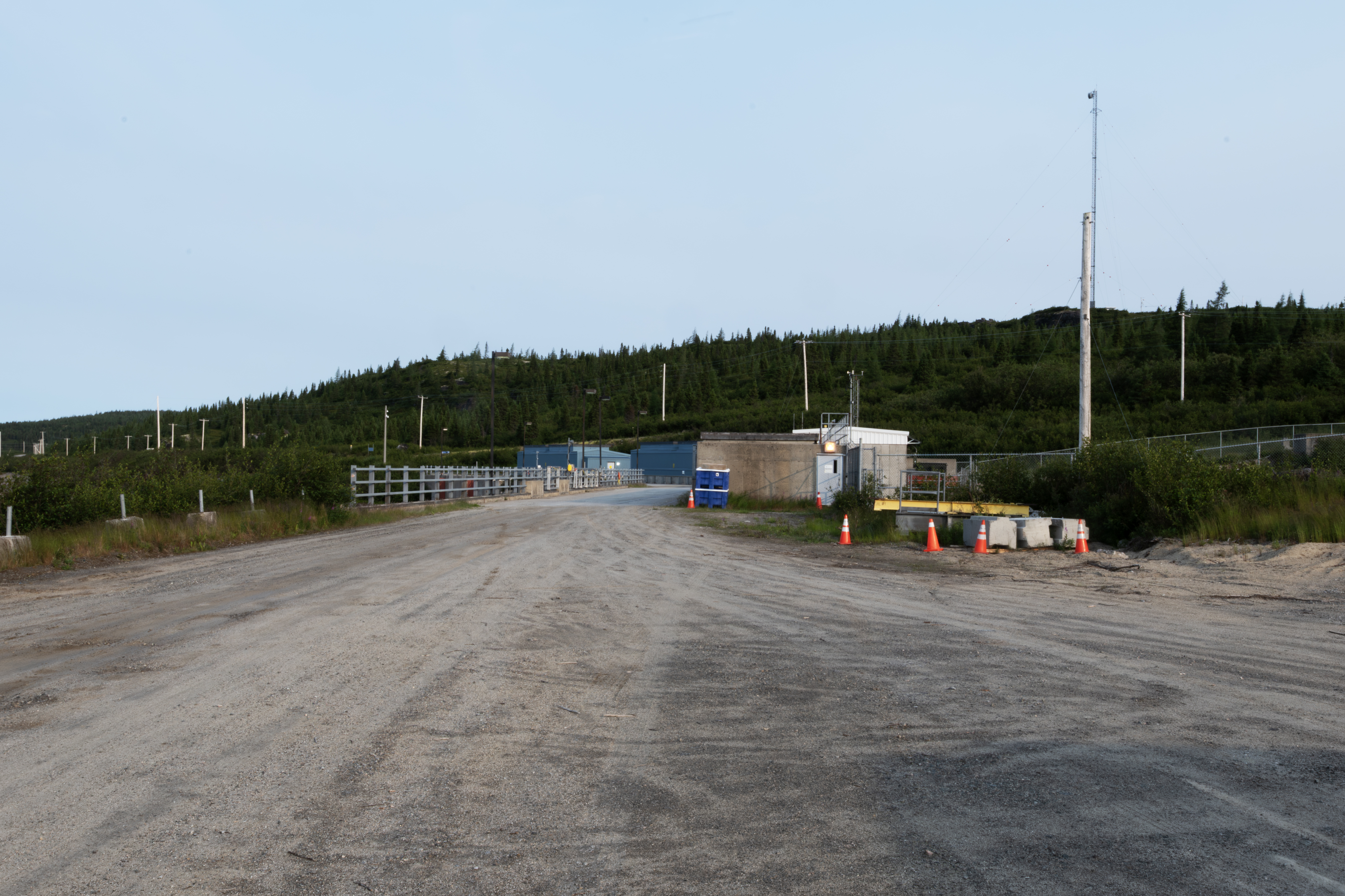
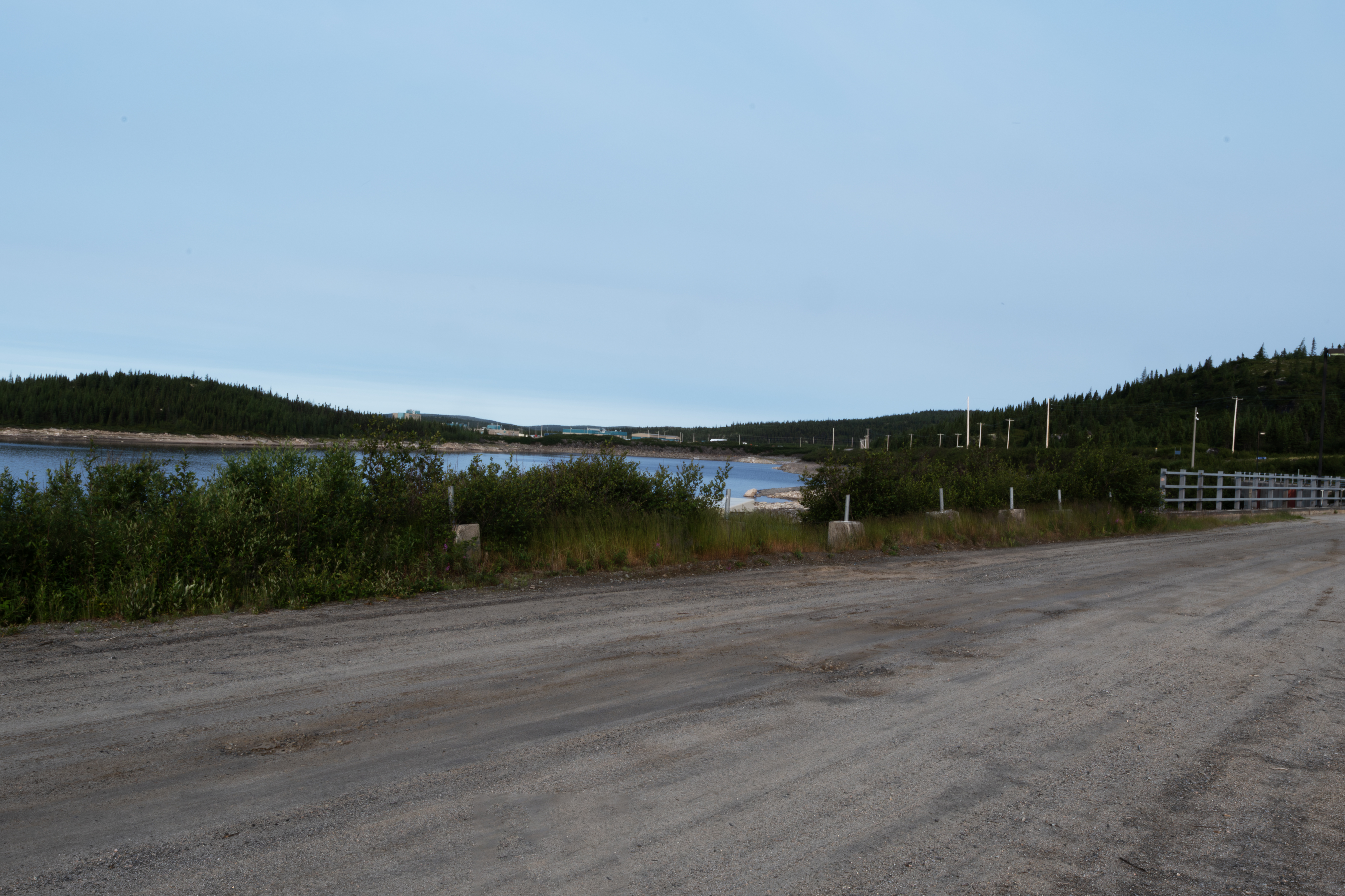
I made it to Brisay the next evening. The next day, July 18th, was raining on and off. This is the boat launch to the north of Brisay. The water had dropped 5 feet from the night before. The northeast USA had been experiencing a heatwave that broke that day, so the dam needed to generate less power, and therefore released less water. Too bad, as I had caught lake trout just past the large rock with the pipe the night before. The water was now too shallow for the fish.
The dam from an observation tower.
Looking toward the river and boat launch.
This Herring Gull was dining on the remains of a lake trout that I had caught the night before. Two weeks later there was not a speck of meat on this carcass.
Late in the day of July 18th, I traveled the road along the west side of the Caniapiscau Reservoir. I would travel from Brisay to the lower center of the photograph to the site marked south culvert.
This shows the upper third of the drive, with the road now visible as a faint white line.
The middle third of the drive.
The end of the drive. I would fish this area with good success for Brook Trout and Lake Trout.
Several communication towers were present along the road.
These Canada Geese were found in a bay of the reservoir close to Brisay.
This momma duck and her crew were observed along the road near the north culvert.
The evening of July 20th I walked along the road for several kms.
This is Arctic Stag's-horn Clubmoss (Lycopodium lagopus).
Another Lycopodium lagopus.
Canadian Bunchberry.
Spooked this Spruce Grouse into a tree.
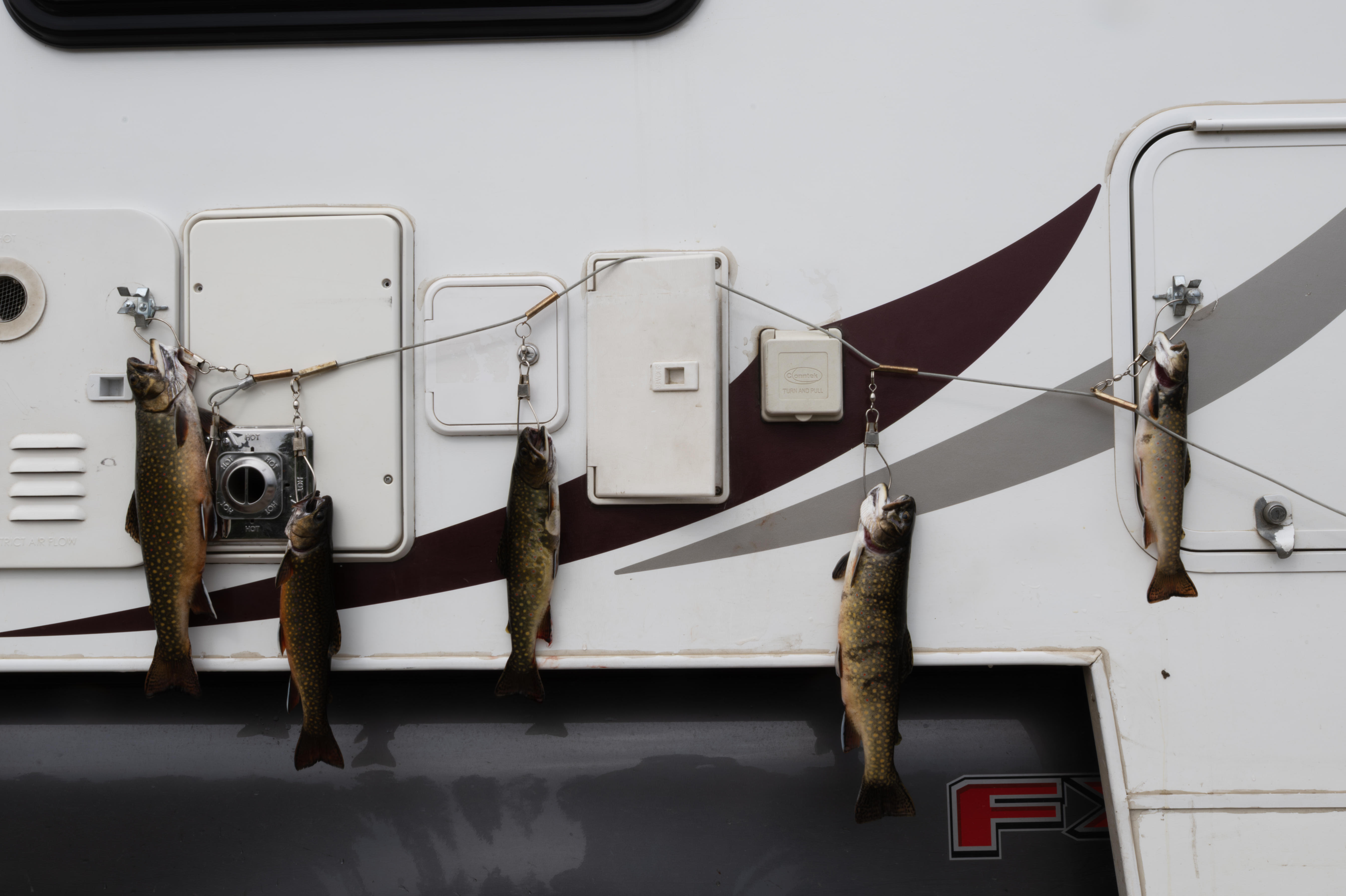
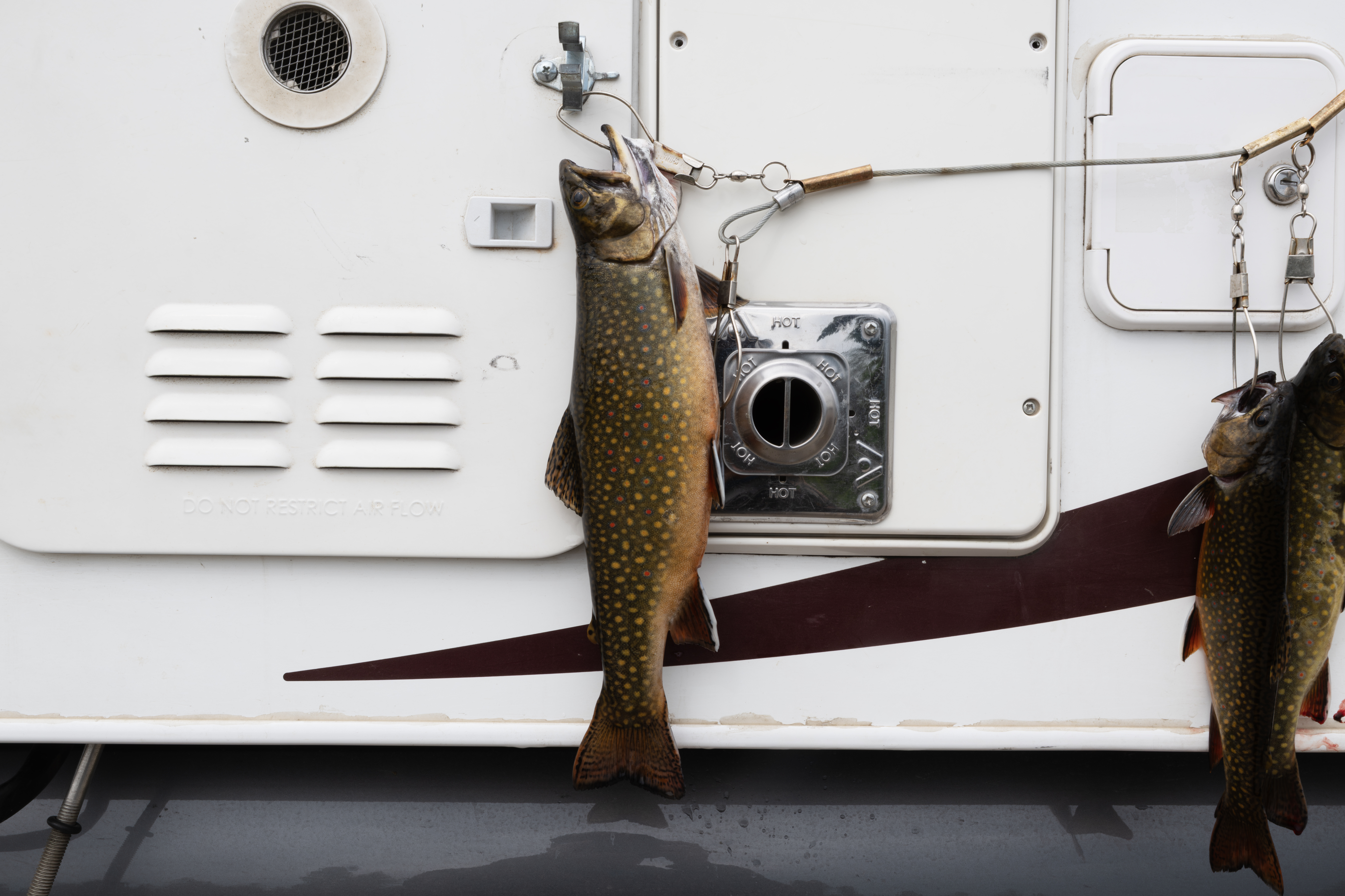
Two nice Brook Trout taken from the north culvert. These always jumped during photo shoots and I was always looking at them.
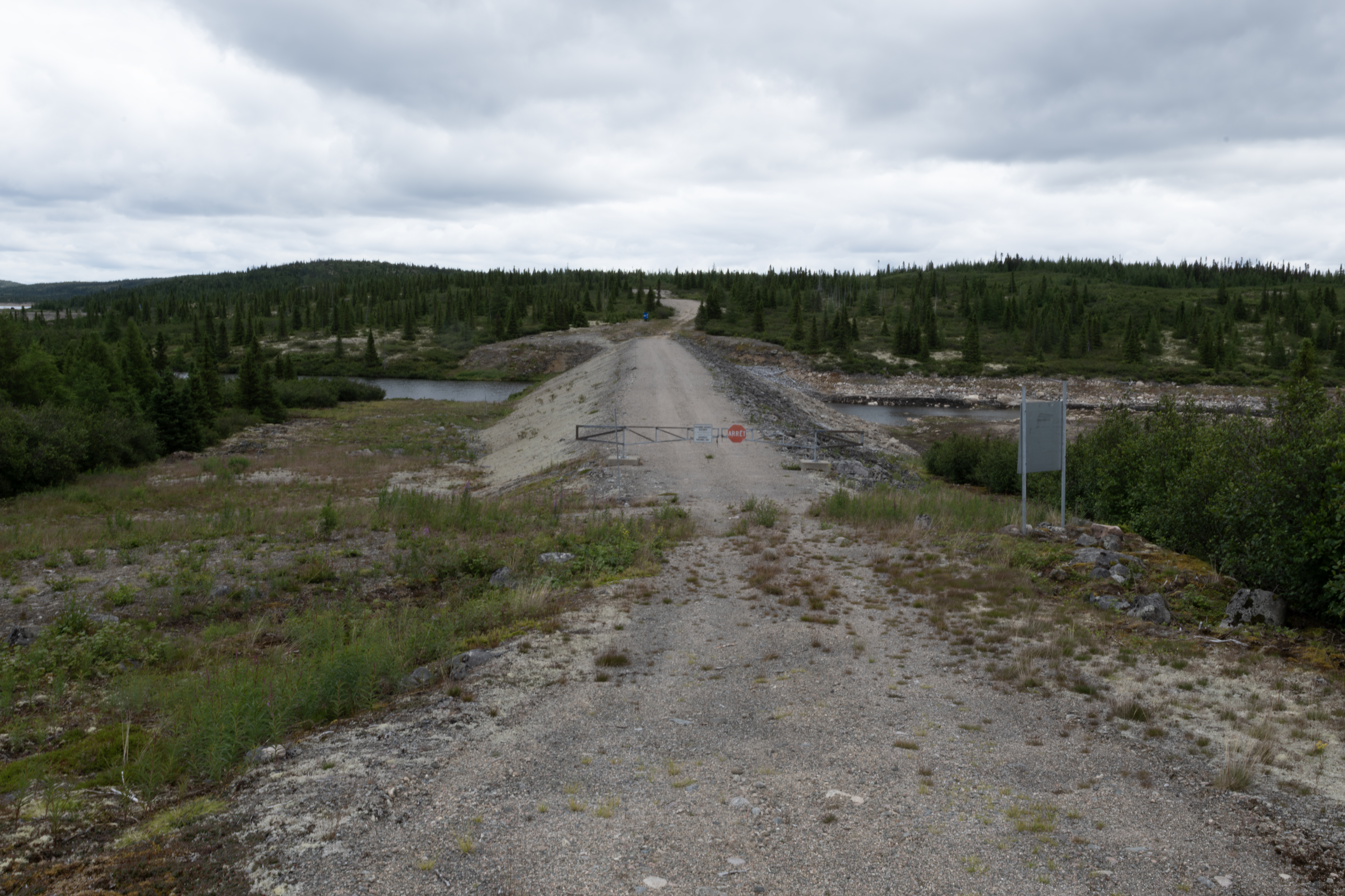
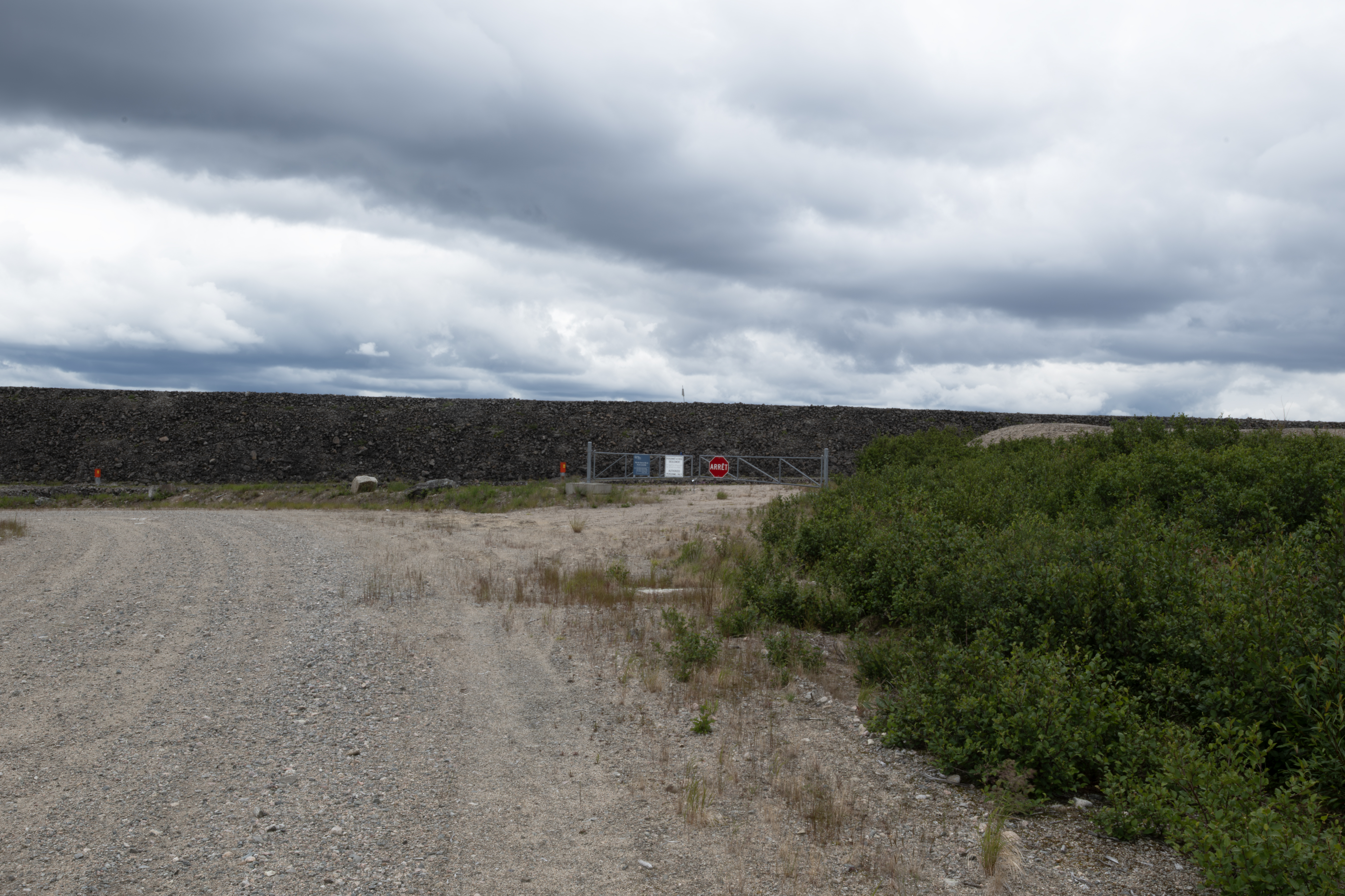
Hundreds of levees along the reservoir system. Most access roads are closed, as for this one.
Just to the south, another levee.
I left the west side road of the reservoir the afternoon of July 21st and headed for Caniapiscau, the very east end of the road. A Common Loon.
Fished for dinner at a culvert about 10 km from the end of the road. I caught a 35 inch northern pike here in 2018.
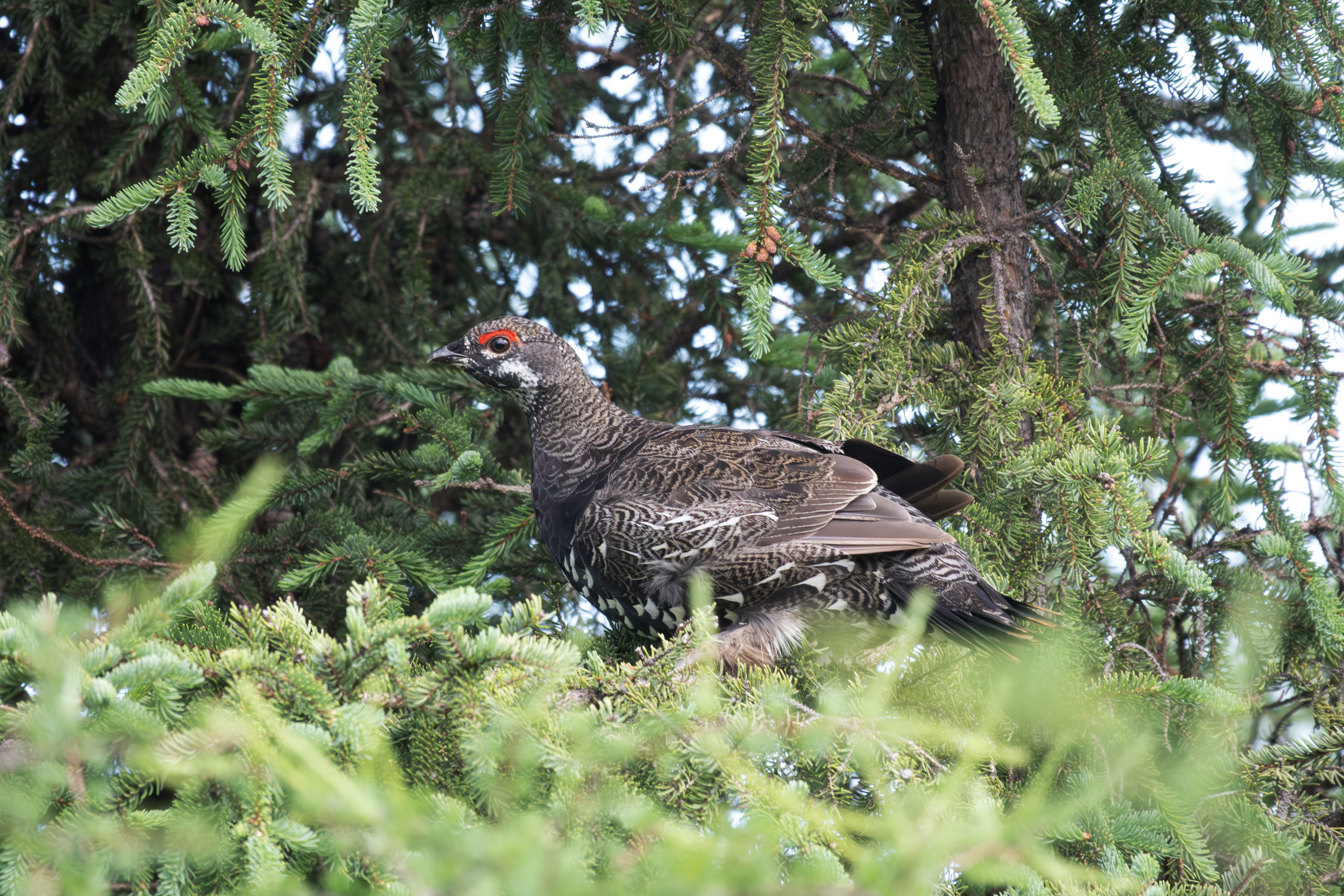
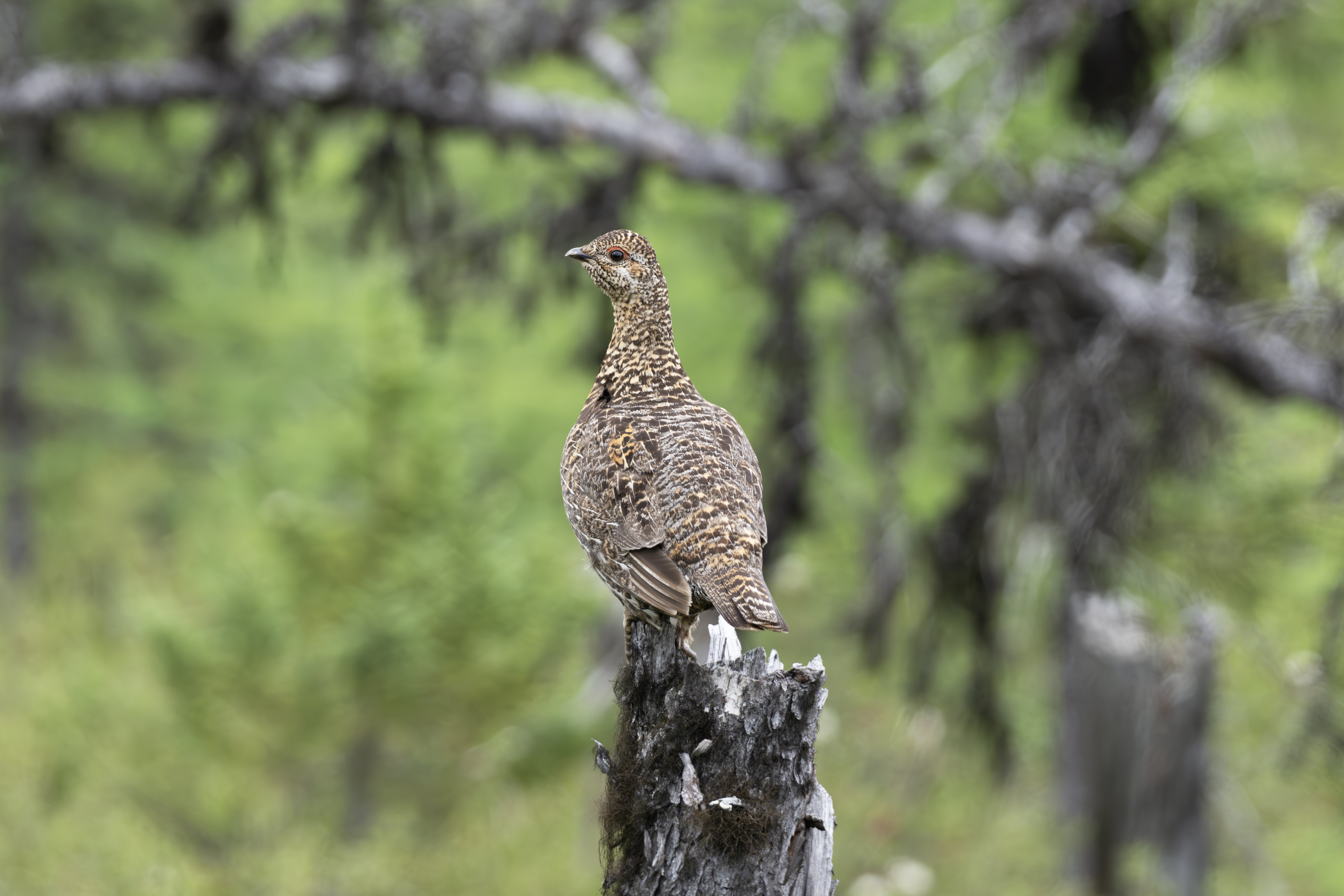
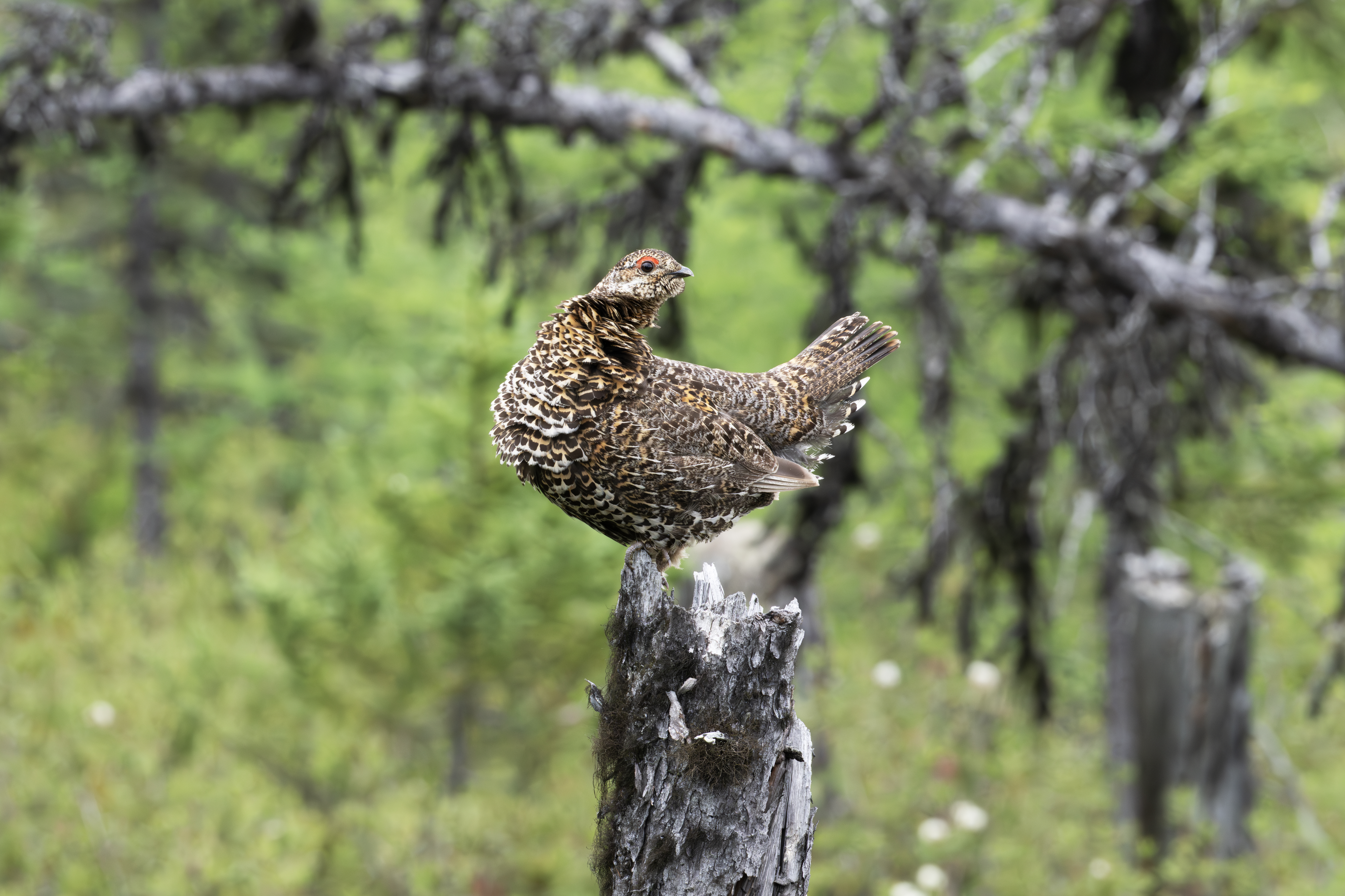
Early the morning of July 22, I spied this grouse on a stump, visible in the middle of the photograph.
I took several close photographs.
Very cooperative.
Eyeing me carefully.
When I got too close, she flew into a spruce tree, and her young flew off. She had been standing guard.
After visiting Caniapiscau, I headed back west. Here is a shot of the crossing over the overflow channel.
The Brisay complex, viewed from the east side of the dam.
The reservoir as seen roadside at the overflow channel.
Brook Trout are found in the many stream crossings along the highway, just below rapids. The larger fish are just below the rapids, whereas the smaller ones are farther back.
The largest of the day.
July 25th, had to visit Radisson, and then returned to the highway.
Returned to the Robert-Bourassa campground, here is the sign at the entrance from the highway. Initially the reservoir was known as La Grande-2, but was renamed after Robert Bourassa who, as Premier of Quebec (1970-1976 and 1985-1994), gave the James Bay Project a vital political impetus.
The gulls swarmed the site whenever I cleaned fish. Here is a shot showing about half of the 2 dozens birds.
Sunset on the reservoir from the boat launch.
July 26th, headed east on the highway toward Brisay.
Much of the first few hundred kms suffered fire damage.
On the way to Brisay, saw this Bald Eagle.
The Bald Eagle nest at the Brisay boat launch.
This is the end of Part A. Click here for Part B.